

Rain totals: More than an inch for parts of Twin Cities metro area
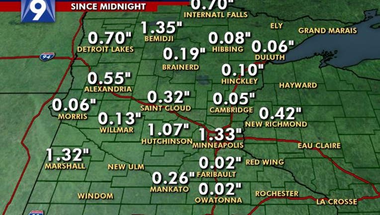
Rain totals statewide for Thursday, June 18.
(FOX 9) - The Twin Cities and southern Minnesota areas are at a slight risk of severe weather Thursday night as storms left more than an inch of rain and power outages in some parts of the Twin Cities metro area.
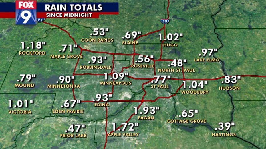
Twin Cities metro area rain totals for Thursday, June 18.
Gusty winds and heavy rain are the main threats of the storm that will continue into the night.

A double rainbow at FOX 9's Eden Prairie studios after the storm Thursday.
More than an inch of rain was reported at Minneapolis-St. Paul International Airport after the storm moved through Thursday evening. More than an inch was also reported in Minnetonka, Buffalo, Lakeville, Burnsville and Eagan.

Storms move into Sibley County, Minn. Thursday evening. (Bill Doms)
According to Xcel Energy, 113 outages affected 3,196 customers as of 8:40 p.m. The majority of the outages are concentrated in the southwest suburbs of Minneapolis.
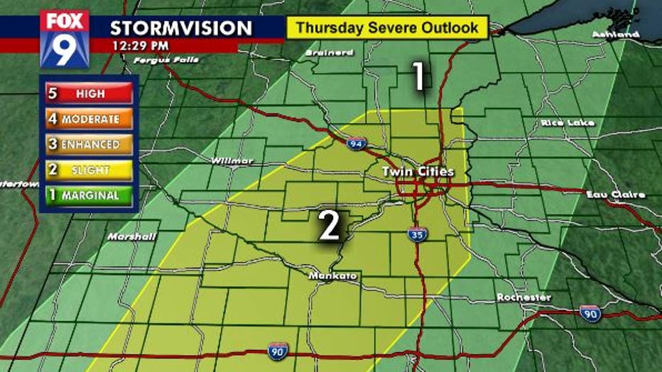
A severe weather outlook for Thursday night, June 18.
People in the FOX 9 viewing area should stay sky aware through the evening Thursday.