

Minnesota weather: Summer-like weather returns just in time for the long holiday weekend

Minnesota weather: Sunshine and high of 77 degrees on Friday
The sunshine returns Friday, with a high of 77 degrees in the Twin Cities. The high Saturday is in the 80s for much of Minnesota, while it'll be cooler in north-central and northeastern Minnesota. It'll be hot and steamy on Sunday, with highs in the mid-80s and plenty of humidity, which could lead to some isolated storms. Memorial Day will see highs approaching 90 degrees.
(FOX 9) - The dreary and cool temperatures are now a distant memory as the heat and humidity gradually build over the long holiday weekend.
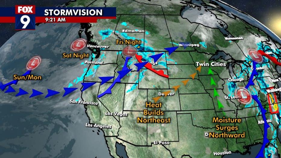
We start off with a wonderfully warm and pleasant day Friday as we sit in between the larger double-barreled system to our east and the unsettled pattern to our west. But our next wave arrives late Friday night, bringing some isolated showers and rumbles to the area through Saturday morning. But with moisture levels limited, heavy rain and severe weather are not expected.
RELATED: Minnesota weather: Here's what could be in store over the summer
However, the heat and humidity will build through the day Saturday and into Sunday. Check out the slow and gradual rise of dew points over the next couple of days:
Dew points will surge from the mid-40s to the mid-60s by Sunday, which will give us a very mid to late summer feel by the latter half of the weekend. And with that much moisture around and temps only continuing to climb, there will be plenty of energy around for storms to develop as a couple of waves roll across the area. One will be more of a glancing blow late Saturday night with some isolated storms possible. However, more widespread storms are looking likely late Sunday and again late Monday. It's these we'll have to watch for the risk of turning severe with large hail, gusty winds, and tornadoes all possible.
(FOX 9)
The heat and humidity will be pretty brief though as temps fall back to the 70s by the middle of next week.