

How warm can we get this weekend?
(FOX 9) - That is a question that houses so much meaning as we head into what is likely to be the warmest weekend in months and could eliminate all but traces of snow left in central and southern Minnesota.
But, there are an unusually high number of factors that will lead to our warmth both Saturday and Sunday. How these variables come to pass could lead to a 15-degree swing for some of us.
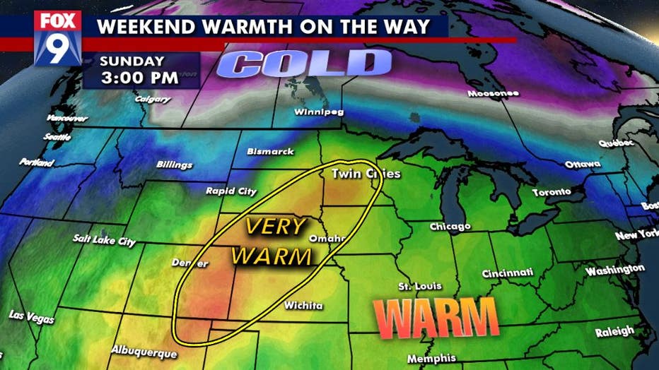
Very warm air will be surging northward into Minnesota over the weekend, but how far north it goes depends on a number of variables
Warm air will be surging northward out of the Southern Plains starting Friday afternoon. Warm air, however, doesn’t move like you think it does. It’s not just simply warm air moving along the ground and heading northward like driving your car down the interstate. Warm air actually moves northward at a level well above our heads. This happens because warm air rises. So as it pushes northward into colder regions, it actually starts climbing in elevation. This leads to the majority of our warm air getting transported northward somewhere between 3,000 and 6,000 feet up. Once it gets above a location, the sun rises and begins to heat the ground.
This allows that warming air near the ground to rise and begin mixing with the cooler air between the ground and the warmer air 3,000 feet above it. At some point during the day, typically by late morning or early afternoon, this rising surface warmth makes it to that warmer air above it and begins to mix. This mixing forces some of this air back to ground level where it heats up even more. It’s this mixing element that is needed to get REALLY warm any time of year, but especially during the spring and fall.
The tough part about this fact though is that there are many days this time of year that this mixing does NOT occur because of our limited sunshine and limited ability to warm the ground because of snow cover. But now that the snow is dwindling quickly, can we actually mix up to 3,000 feet? That’s the million dollar question.
So what happens if we don’t? Well, those 60s on Sunday turn into upper 40s and low 50s. What if we mix more than expected? Well, then those 50s and 60s on Sunday turn into 70s. Sounds like a crapshoot doesn’t it? Well, honestly it pretty much is. But, experience and other variables can help us determine what the outcome can be.
Other factors include wind direction, cloud cover, snow cover, computer model bias, wind speed, atmospheric temperature pooling, moisture content and about a thousand other things. Ultimately though, cloud cover, wind direction and snow cover in your location will likely determine just how warm you get.
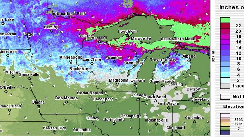
This is the current snow depth based off computer model interpretation. When snow begins to melt, it can take several days for computer models to interpret that factor. Therefore the days following some significant melting, temperatures are often dra
For example, in areas that still have significant snow cover north of I-94, it will not be in the 60s this weekend. Plenty of 40s, and maybe even a few 50s, but that’s likely the extent of it. For areas though that don’t have significant snow pack left, then 60s are certainly possible for Sunday. But, it will depend on where the cold front ends up sitting and just how much cloud cover rolls in.
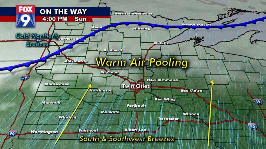
A snap shot to Sunday afternoon where there will be an approaching cold front and cloud cover across much of the north, but sunshine and southerly flow in the south. This is likely to lead to a large temperature gradient across the state, but the exa
Futurecast has this cold front across far northern Minnesota, with the associated clouds stretching a bit further south from there. BUT, if these end up further south, then there will be far fewer of us that get into those warm temperatures on Sunday.
What is even more amazing to see though, is that there could easily be a 40-degree temperature spread statewide Sunday afternoon with the Interstate 90 corridor close to 70 while areas near the Canadian border hover near the freeze mark. It ill be a very interesting weekend and a fairly typical Minnesota spring-like day.