

Quick one-day heat wave before Twin Cities heads back to deep freeze

Friday's forecast: Coldest morning of the season
Temps will climb through out the day, with Saturday seeing a high near 30.
(FOX 9) - The Twin Cities hit a low of 17 degrees below zero Friday morning, with the suburbs and northern Minnesota getting even lower, making this the coldest morning of the season in the metro so far.
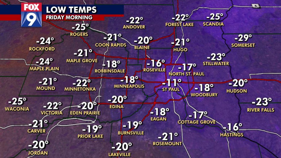
Subzero temperatures are nothing unusual this time of year. In fact, in the average year, our lowest temperature should be 18 degrees below zero, so the temperatures this Friday morning are perfectly typical.
Friday morning low temps
- Bemidji: -36 degrees
- Brainerd: -34 degrees
- Hibbing: -33 degrees
- Alexandria: -28 degrees
- St. Cloud: -26 degrees
- Minnetonka: -22 degrees
- Maple Grove: -21 degrees
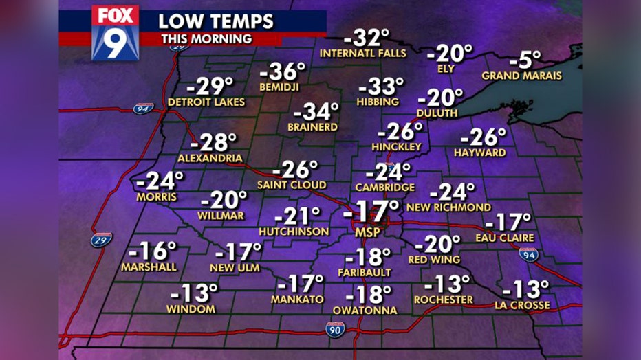
- Red Wing: -20 degrees
- Duluth: -20 degrees
- Burnsville: -19 degrees
- Woodbury: -18 degrees
- MSP Airport: -17 degrees
- Mankato: -17 degrees
- Rochester: -13 degrees
Nearly 50-degree swing from Friday to Saturday
The bitter cold won’t linger, however, as we are going to warm up slowly throughout the day and into Saturday. We’ll get back above zero Friday afternoon, but then temperatures continue climbing through the night as a warm front passes across the state. This front will bring more clouds, a dash of light snow for areas north of Interstate 94, and gusty breezes.

Temps go from subzero Friday to around 30 degrees Saturday
It will be a quick one-day heat wave from Friday to Saturday before we return to the deep freeze.
That front though will push temperatures back into the teens as we wake up Saturday morning. It will be a quiet and mild Saturday with highs near 30 degrees, before winds pick up out of the northwest and temperatures plummet again Saturday evening.