

Another week, another tropical system
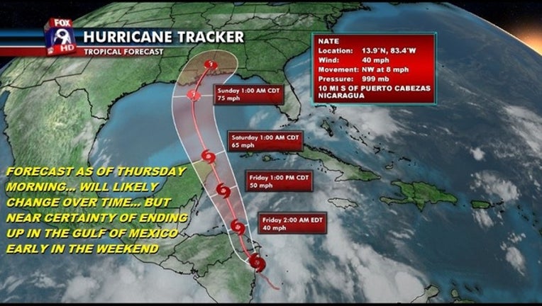
KMSP - While we are now into October and heading for colder weather, the tropical Atlantic is still quite warm and quite capable of producing more tropical systems. In fact, hurricane season doesn’t officially end until after Thanksgiving on November 30th which means we still have a couple months to go in an active tropical season. Well, our next tropical storm has now formed, in a somewhat unusual spot… over land! Tropical storms need warm ocean waters to sustain vigorous intensity, but once in a blue moon, atmospheric conditions are ripe enough that these ocean monsters can spend some time over land and not be affected… and that is the case here. As of this post, Nate was centered over the coast of Nicaragua and unfortunately it’s heading north. The current forecast from the National Hurricane Center takes it up the coast of Mexico, over the Yucatan peninsula and into the Gulf of Mexico early in the weekend. Then it’s likely to impact the US sometime on Sunday. While the exact track and intensity are unknown at the moment, the likelihood of this storm making a US landfall is growing by the hour and could become a near certainty by sometime on Friday as the storm picks up steam and becomes a bit more predictable. Stay tuned!