

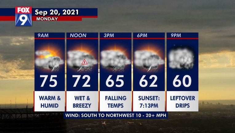
Scattered storms to arrive in the Twin Cities around midday
From a summer-feeling morning to a fall-feeling afternoon, brought to you by a cold front. (FOX 9)
(FOX 9) - Scattered rumbles arrive in the Twin Cities midday and will likely hang around through the afternoon and into the evening.
Some of these storms could be strong as the metro is in a level one risk for severe weather with gusty winds and heavy rain as the main threats.
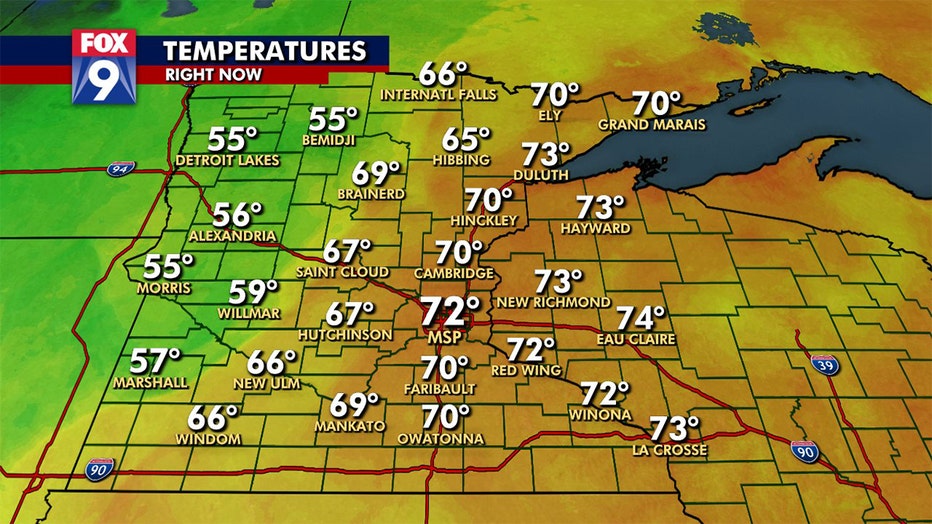
Cold front slowly moving southeast, still warm and soupy in the Twin Cities with temperatures in the 70s, but mid 50s to the northwest. Falling temperatures are still expected by mid to late afternoon.
However, the best opportunity for strong storms will stay south and east of the metro. Some spots in Minnesota could pick up more than an inch of much needed moisture, especially in the north.
The rumbles will push eastward this evening allowing the metro to dry out late tonight.
Get the FOX 9 Weather App to track storms live on your phone, with future radar, live streaming video of FOX 9 coverage and alerts and forecasts customized for your current location and favorite locations. Download it for Android or Apple.