

Minnesota weather: Flurries possible before things warm up for weekend

Wednesday's forecast: Mostly cloudy with highs in the upper 30s
Light snow possible later tonight. Thursday's high will be around 36.
MINNEAPOLIS (FOX 9) - There's a chance for some flurries before things warm up for the weekend.
A misty, gray Wednesday morning as temperatures cool off. This could lead to some slippery spots during the morning commute before temperatures rebound into the mid and upper 30s Wednesday afternoon all while we play peek-a-boo with the sun.
A storm system is passing to Minnesota's south, which could bring some flurries to the Twin Cities. A touch of light snow is possible in southern Minnesota, along the Interstate 90 corridor, after sunset Wednesday. The vast majority of the snow will stay in Iowa, though.
Thursday morning will be dry with lingering cloud cover. The sun returns in the second half of the day, with highs in the mid-30s in the Twin Cities in 20s in northern Minnesota.
Most of us will warm a solid 10 degrees heading into Friday, as high temperatures return to the 40s for the weekend.
The average high for this time of year is 45 degrees. The average low is 28 degrees.
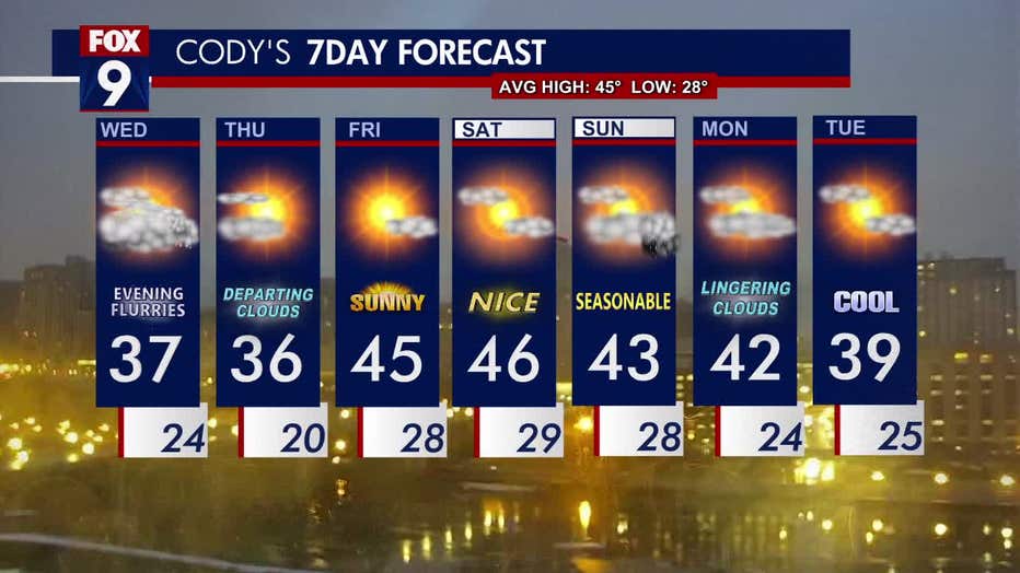
The seven-day forecast.