

Minnesota weather: 70s likely to return Saturday for first time in 6-plus months

Thursday's forecast: Sunny in the 50s
Thursday will be the warmest day in over a week with temperatures in the 50s and plenty of sunshine.
(FOX 9) - While spring officially started more than a month ago, it hasn't really felt like it so far. Temperatures have been running several degrees below average overall this month leading many to question whether spring will actually show up.
Well, our pattern continues to encourage some cool temps, but a large storm system pushing through the Upper Midwest this weekend will give us a one-day heat wave, likely pushing 70s into the Twin Cities for the first time this year.
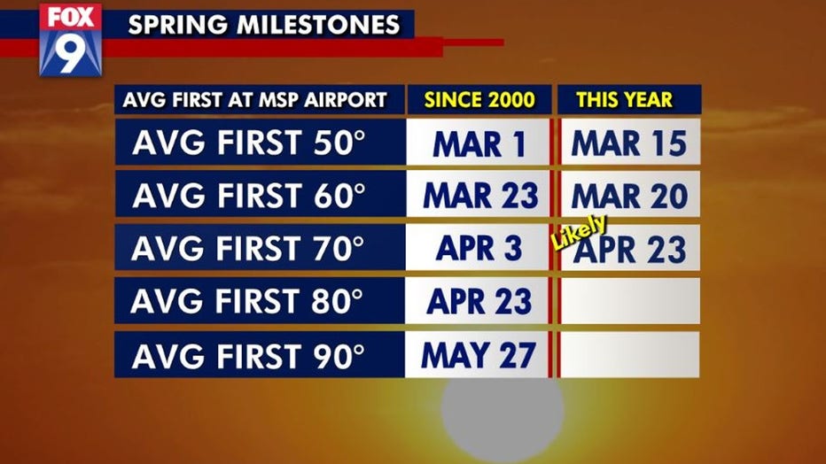
It's been more than 6 months since temperatures have topped 70 degrees in the Twin Cities, dating back to Oct. 19 of last year. Since the year 2000, our average first 70-plus degree day has occurred on April 3. While nothing in the weather world is a certainty, it's highly likely that we get our first 70-plus degree day this year on Saturday, April 23, nearly 3 weeks behind the average and the latest in the year that has happened since the VERY cold April of 2018.
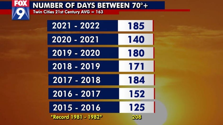
More interestingly though, this will mark a 185-day stretch between our last 70-plus degrees of 2021 and the first of 2022. That's the second-longest stretch since the year 2000. Still 3 weeks shy though of the record 208 days set back in 1981-1982.
We are not only going to get a push of warm air, but we are likely to see a big jump in moisture. This will give us our first taste of spring- and summer-style humidity as dew points likely surge into the low 60s. That's a pretty typical air mass for mid-summer, but far less common in April. And since it will be the first one of the year, it will certainly feel more humid than it has in a long time.
The warmth will be far from picture perfect though as the combo of warm temps and moisture could lead to some occasional rain and thunderstorms from Friday through Saturday. If these thunderstorms can develop, they run a level 2 risk of severe weather across much of central and southern Minnesota, including the Twin Cities metro. Plenty of wind will accompany the weekend with gusts over 30 mph likely at times from Friday through Sunday.
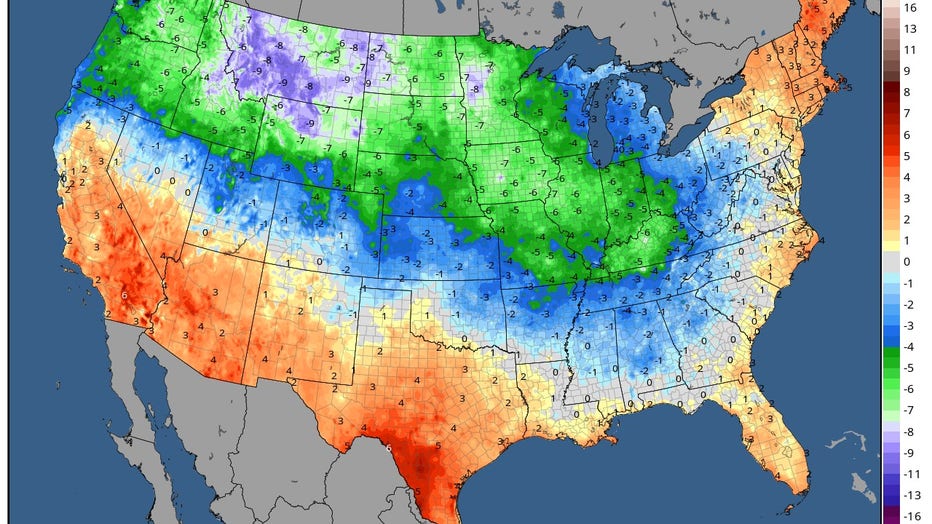
Misery does love company as Minnesota hasn't been the only spot that has been well below average so far this month. Much of the northern tier of the country has seen a pretty chilly start to the month. Places that have seen some epic snow over the last couple of weeks have been the coldest when compared to average, generally in the High Plains of Montana, North Dakota, and Wyoming, but also parts of western Minnesota.
After the brief heat wave over the weekend, temperatures return to below average levels likely for much of next week.