

Rain with some thunder possible overnight for Twin Cities

Tuesday: Storms moving in overnight, bringing rain to some, snow for others
We could hear some overnight rumbles in the Twin Cities as storms push through overnight.
(FOX 9) - A slew of precipitation types moved into Minnesota starting late Tuesday and will continue through Wednesday and Wednesday night. But some areas will see a lot more liquid than others and vice versa.
The typical spring mess begins late Tuesday and Tuesday evening where showers are likely to develop on the nose of a strong push of warm air that ends up just to our south in Iowa. This will give much of southern & central Minnesota some rain, with the opportunity for lightning and thunder to mix in. All of this happening while northern Minnesota transitions quickly from rain, to sleet, to snow.
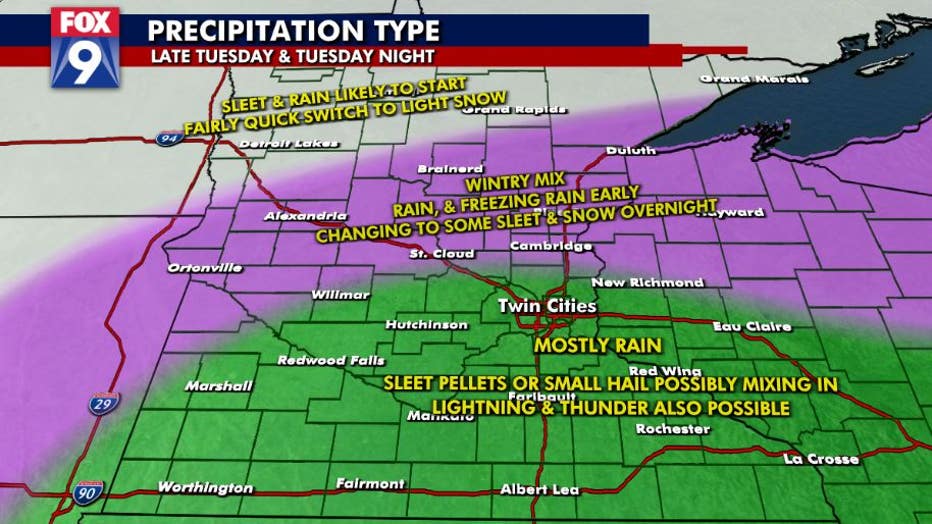
Can will arrive later Tuesday. (FOX 9)
But that transition zone will gradually push southeastward through the day Wednesday as the atmosphere gradually cools. This will give all of us the opportunity for some minor snow accumulations late Wednesday & Wednesday night with splotchy accumulations of 1"-3" will be possible, generally though, just on cooler grassy surfaces.
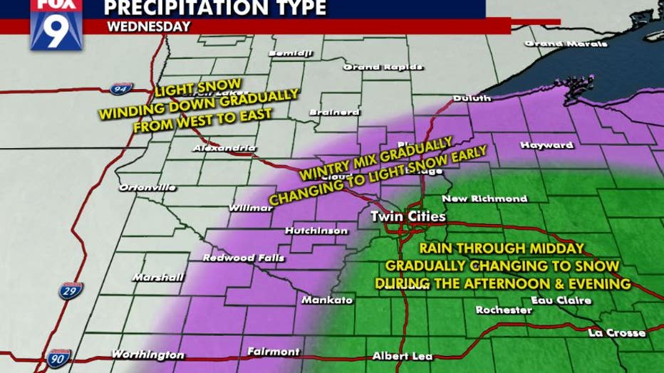
Snow is possible Wednesday.
Accumulating precipitation will be done late Wednesday night with just some lingering flurries Thursday. While it won't be warm, temps will generally be in the upper 30s by the afternoon, so whatever snow accumulates won't hang around long.
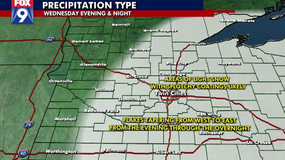
Most of the snow accumulation will be on cooler, grassy areas. (FOX 9)