MN weather: Snow turns into rain Monday
MINNEAPOLIS (FOX 9) - Wet heavy snow will continue to fall this evening with occasional bursts of very heavy snow together with gusty east-northeast winds.
READ MORE: Minnesota, Wisconsin school closings, delays for March 25, 2024
For the latest forecast, click here.
This storm will also have an impact on the metro but the limiting factor on any massive snow accumulations from the metro to the south is twofold:
- Temperatures do not drop below 30 degrees overnight increasing to the upper 30s after mid-morning Monday. Warm temperatures keep the rain-to-snow ratio much lower than average…11:1 to 13:1 is average, this storm is more 6:1 to 8:1
- -Measuring this heavy wet snow will be a troublesome task as the compaction rate is very high… it literally compacts down on itself as it accumulates.

Minnesota weather: Snow turns to rain on Monday
A spring snowstorm on Sunday has brought flakes throughout the day to Minnesota. Monday, the precipitation turns to rain.
Sunday morning started with some light snow that struggled to stick to surfaces. The rest of the week is expected to be pretty mild with mostly sunny days and temperatures in the 40s.
As of Sunday evening, the metro snow forecast is still in the five to nine-inch range. The snow transitions to rain early Monday morning. Rainfall could top one inch on Monday with heavy rain possible from mid-morning through late afternoon. There will be a chance of area-wide thunderstorms Monday night.
Timeline of what to expect with Sunday's snow
Expected snow accumulations
This snowstorm may lead to a big contrast in snow accumulations – even across the Twin Cities. Higher amounts are expected in the northwest metro and even more so heading northwest on Interstate 94 toward St. Cloud. The southern and southeastern areas of the Twin Cities will likely see less snow.
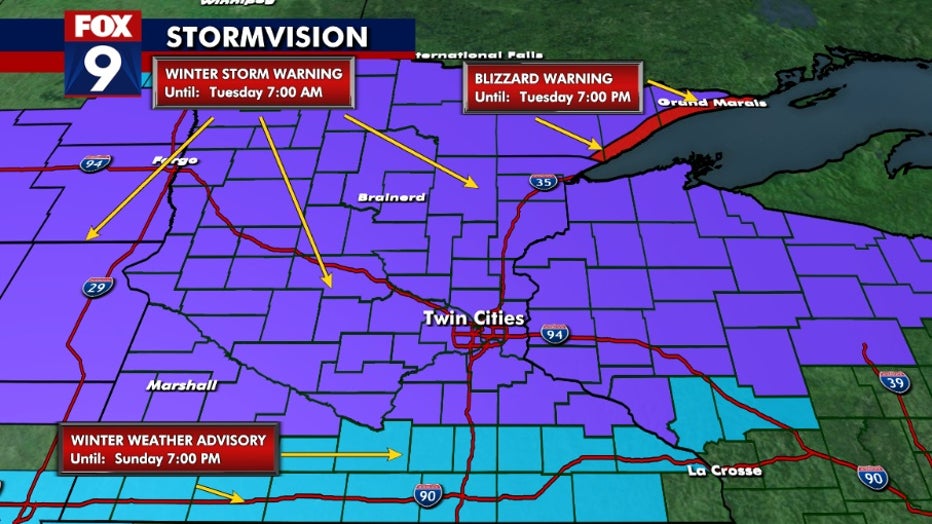
Weather warnings