

El Niño 2026: Why this year's pattern could mean warmer Minnesota winter
How the 'Super El Niño' could affect our weather
This winter, we are expecting to see what is called a "Super El Niño." FOX 9 meteorologist Cody Matz spoke with Dr. Kenny Blumenfeld, Minnesota, senior climatologist for the Minnesota Department of Natural Resources, about what exactly this could mean for us in Minnesota.
(FOX 9) - A super El Niño, possibly the strongest in decades, is here, and the Minnesota Department of Natural Resources (DNR) says it could shape this year's winter by making it notably warmer and wetter than average.
What is a super El Niño?
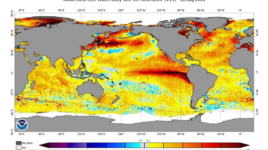
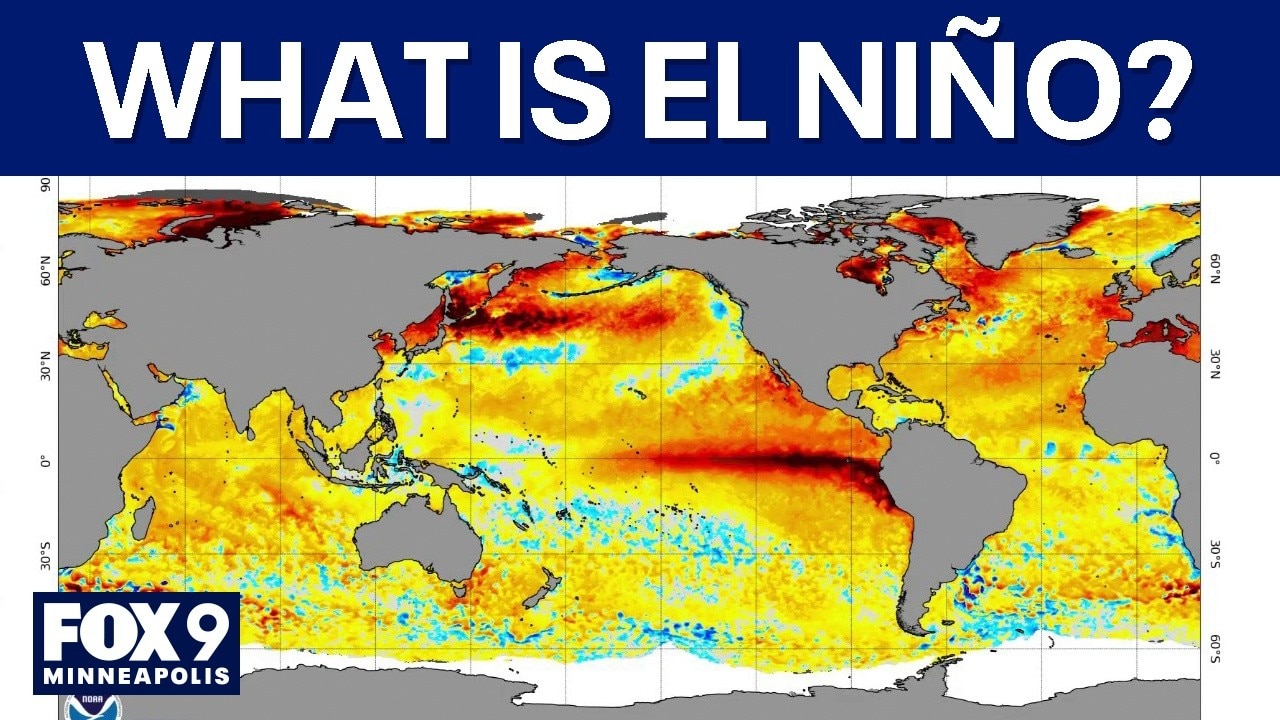
Image from the National Oceanic and Atmospheric Administration shows coral reef anomalies from Aug. 18, 2026. (Supplied)
What they're saying:
DNR Senior Climatologist Dr. Kenny Blumenfeld explained the phenomenon and what it means for Minnesotans.
"It's not a storm, it's not rain or snow. It's just the result of a pattern that emerges in the Pacific Ocean, and it's a name for that particular pattern," Blumenfeld said.
Blumenfeld explained during an interview with FOX 9 meteorologist Cody Matz that the warming changes wind speeds, slows ocean currents and ultimately shifts weather patterns across the globe, including in Minnesota. When that circulation pattern slows down, warm water near South America's coast gets more time to heat up under the equatorial sun. That extra heat changes how winds blow, how currents move and where storms form — with ripple effects that reach all the way to the Upper Midwest.
"Even the weather systems that affect us here in Minnesota, they have traveled across the oceans," said Blumenfeld. "They've often traveled around the world multiple times and just kind of been transformed as they interact with different areas of warm and cold air, warm or cool water."
How does El Niño split the jet stream?
El Niño: What it is, how it affects our weather
What is El Niño, where does it come from and how does it affect our weather? FOX 9 Meteorologist Cody Matz spoke with Dr. Kenny Blumenfeld, Minnesota, senior climatologist for the Minnesota Department of Natural Resources about how this year’s El Niño weather pattern could affect our winter.
Minnesota stuck in the middle:
One of the most direct ways El Niño affects Minnesota is through the jet stream. During a strong El Niño, the wintertime jet stream tends to split into two branches — one tracking far to the north and another dipping toward the U.S.-Mexico border.
"Rather than having the wintertime jet stream tracking right over the center of North America, where we get hammered by a bunch of winter storms, you end up having one stream that ends up way to the north and then another stream way to our south near the Mexico kind of U.S. border, where it tends to get very wet and kind of inclement," Blumenfeld said.
That leaves Minnesota in the middle — typically with milder air and inconsistent precipitation.
"We tend to have warm winters during that time with kind of inconsistent precipitation," Blumenfeld said. "Hard to access some of the cold air."
What does this mean for Minnesota's winter?
This winter's El Niño could be strongest on record
FOX 9 Meteorologist Cody Matz spoke with Dr. Kenny Blumenfeld, Minnesota, senior climatologist for the Minnesota Department of Natural Resources about what to know about this year’s El Niño weather pattern.
Local perspective:
Blumenfeld explained that the intensity of El Niño matters a lot when it comes to forecasting Minnesota's winter.
Stronger events tend to produce more dependable warm conditions, while weaker ones leave more room for cold air to sneak in.
How can forecasters test if this super El Niño changes the winter outlook?
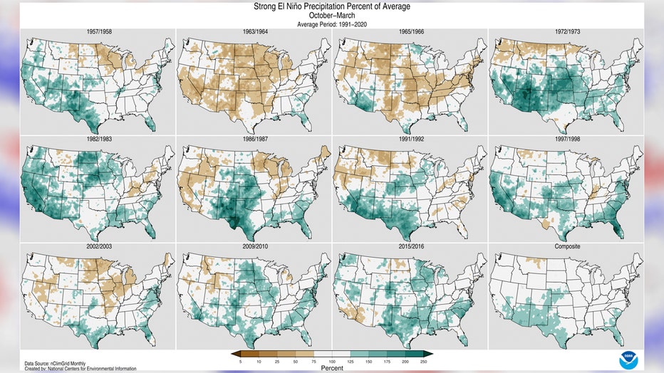
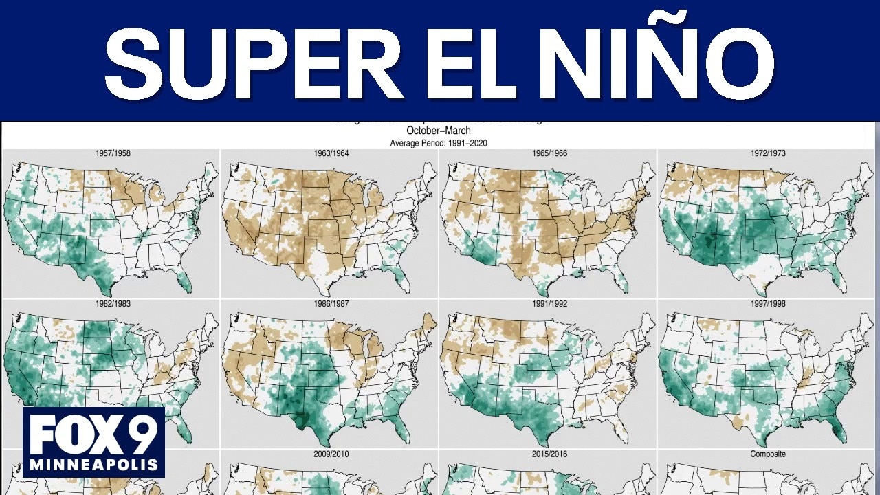
Image shared by the National Oceanic and Atmospheric Administration shows varying precipitation averages from pervious strong El Niño systems.
Crunching the data:
El Niño is not the only factor at play. Other ocean temperature patterns — including warm water near Japan and Korea and conditions in the Atlantic — also influence Minnesota's weather. Atmospheric patterns like the Arctic Oscillation, which shifts above the North Pole, add another layer of uncertainty.
"Some of that variation is because of all the other things going on globally," Blumenfeld said. "Different ocean currents, different weather patterns, also different phases that have differing levels of difficulty in terms of predictability."
Why do some El Niño winters still produce major snowstorms?
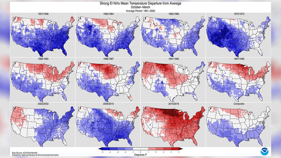
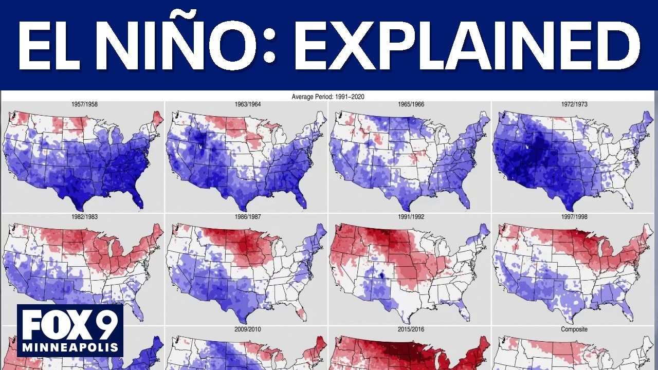
Image shared by the National Oceanic and Atmospheric Administration shows varying temperatures from pervious strong El Niño systems. (Supplied)
Dig deeper:
The 2015-16 El Niño, one of the strongest on record, showed up as deep red on temperature maps — well above average across the state. Precipitation during that season was slightly above normal, but much of it fell as rain rather than snow.
"We'll often get precipitation that's not that far off of normal, but less snow frequently," said Blumenfeld. "And we've had some doozy snowstorms during big El Niño winters."
Halloween blizzard of 1991
The backstory:
Blumenfeld pointed to the 1991-92 winter as a prime example. That season was also a super El Niño — and it produced the infamous Halloween blizzard.
"That November of 1991 is the snowiest month of any month on record," said Blumenfeld. "But then the rest of the winter was pretty dull. It ended up being mild with a lot of fog and a lot of days above, near or above freezing, which started eating into the snowpack."
The Source: This story uses information from an interview with Minnesota Department of Natural Resources Senior Climatologist Dr. Kenny Blumenfeld.