

Slight Risk of severe weather south of I-94, Enhanced Risk for south MN
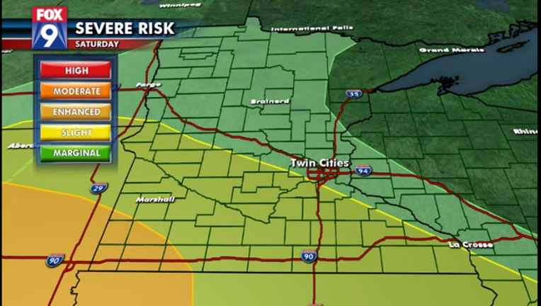
(FOX 9) - Areas south of Interstate 94 - including parts of the metro - are under a Slight Risk of severe weather tonight, while southwestern Minnesota is under an Enhanced Risk.
Most of the day will be warm and muggy with temperatures in the 80s and dew points in the 60s. This lays the groundwork for strong to severe thunderstorms to develop ahead of a cold front starting in northwestern Minnesota and the eastern Dakotas. It will then spread eastward this evening and tonight.
While this will be the main threat scenario, there could be a couple of isolated storms that develop in southern Minnesota toward the dinner hour and tonight. These potential isolated storms would also run a severe risk. Large hail will be the main risk with the isolated storms initially, but once they congeal into a line, strong wind gusts to 70+ mph will be the main threat as the line quickly moves east.
Severe Timing:
• 4pm – Midnight for Western and Central MN
• 10pm – 4am for the Metro
• 2am – 6am for Western WI
Key Threats:
- Damaging Wind Gusts (60+ mph)
Secondary Threats:
- Large Hail (1” or greater)
- Isolated Tornadoes
- Torrential Downpours