

Rain chances finally return, but so does possibility of severe weather
(FOX 9) - Our warm and soupy air mass may finally produce some rainfall late Friday afternoon and Friday night as a cold front moves through the region. However, that front may also produce some stronger storms capable of strong gusty winds, some quarter size hail, and even a brief tornado or two.
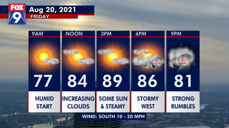
Another warm and humid start, with plenty of tropical heat this afternoon. Clouds will increase through the day with storms rolling from western Minnesota eastward late Friday and Friday evening. (FOX 9)
Most of the day will be quiet in the Twin Cities as storms stay across the Dakotas until the mid to late afternoon. That’s when they should develop in earnest across the western part of the state and will push gradually eastward.
These storms should form into a line giving many of us an opportunity for some rain. Best chances for the Twin Cities to get wet will be between 7 p.m. and Midnight. We’ll clear out overnight and see a cooler and more pleasant weekend.
Stay sky aware!
Get the FOX 9 Weather App to track storms live on your phone, with future radar, live streaming video of FOX 9 coverage and alerts and forecasts customized for your current location and favorite locations. Download it for Android or Apple.