

Minnesota weather: Sunshine turns hazy, unsettled later this week

Tuesday's forecast: Forest fire haze rolls into the atmosphere, highs in the 80s
More of the same Wednesday.
(FOX 9) - Plenty of sunshine and a bit warmer on Tuesday, with haze from wildfire smoke rolling into Minnesota for the middle part of the week.
The high on Tuesday will climb to about 81 degrees in the Twin Cities metro, which is about 10 degrees above average. Much of central and southern Minnesota will see temperatures in the upper 70s and around 80 degrees on Tuesday. However, with very dry air in place, Tuesday will still feel quite comfortable.
There will be plenty of sunshine on Tuesday, eventually turning a bit hazy in the afternoon due to westerly breezes that are bringing in smoke from the wildfires in the western United States.
This will be upper-level smoke that will give us that milky sky that's become more common in the late summer and early fall, but it won't have much impact on air quality at the ground level due to it being upper-level smoke. The haze will stick around for the middle part of the week.
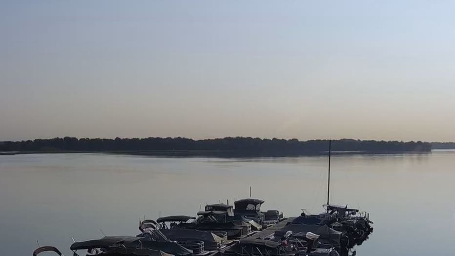
Hazy sunshine over White Bear Lake the morning of Sept. 13, 2022.
The low Tuesday night will dip down to about 57 degrees, with widespread 50s expected for lows for much of the state.
Weather turns unsettled
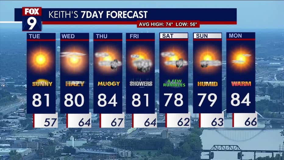
The seven-day forecast.
On Wednesday, the high will be 80 degrees in the Twin Cities metro, with upper 70s and 80s expected across much of central and southern Minnesota. More hazy sun is expected on what will be one of the last calm days for a while, as things become unsettled starting on Thursday.
Looking ahead, some popcorn showers or an isolated storm are possible on Thursday, when the high will be around 84 degrees and muggy. The best chance for showers, though, is on Friday, when the high will be around 81 degrees. A few rumbles of thunder are possible on Saturday, but otherwise the weekend will feature sunshine, humidity and highs in the upper 70s.
We'll return to the middle 80s on Monday.