

Spring-style storm brings rain to Twin Cities, slushy snow to northern Minnesota
A very spring-style storm is hitting Minnesota Wednesday. (FOX 9)
(FOX 9) - A very spring-style storm is rolling through the state Wednesday and Wednesday night with off and on rain for the Twin Cities metro.
The dividing line between much cooler air to the north and much warmer air to the south will likely slice through the Twin Cities with high temperatures in the upper 30s to mid 40s on the northwestern half, and from the mid 40s to mid 50s in the southeastern half.

Tuesday’s forecast: Rain, severe weather possible
Rain in the Metro, severe weather warning for the Twin Cities and Eastern Minnesota this afternoon
These rounds of rain could interact with additional moisture and spin in the atmosphere to create the potential for a few isolated severe storms late this afternoon and evening from the Twin Cities and points southeastward. Large hail, damaging winds and even an isolated tornado cannot be ruled out.
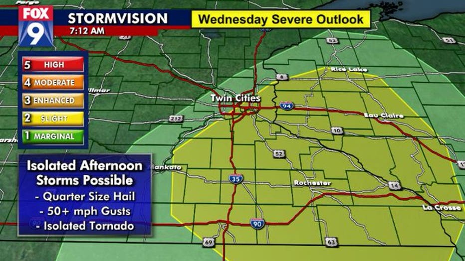
Severe weather outlook for Wednesday, March 10. (FOX 9)
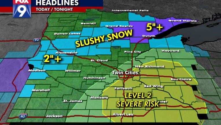
Once the severe threat passes this evening, all eyes turn to the north where rain will be switching over to snow from western to northeastern Minnesota. A swath of heavy, wet, slushy, sloppy snow is likely from Madison and Alexandria in western Minnesota to the Brainerd Lakes area, Grand Rapids and over to Duluth and the North Shore. Several inches will be possible, with upwards of 8 inches in parts of the Arrowhead.
While the Twin Cities could get a few flakes dancing their way in overnight as this storm wraps up and heads eastward, no accumulation is expected.
Stay up to date on the weather by downloading the FOX 9 Weather App. It has the latest temperatures, forecasts and school closings 24/7. Download it for Android or Apple.