

Potential for severe weather Monday and overnight for much of Minnesota, Twin Cities included
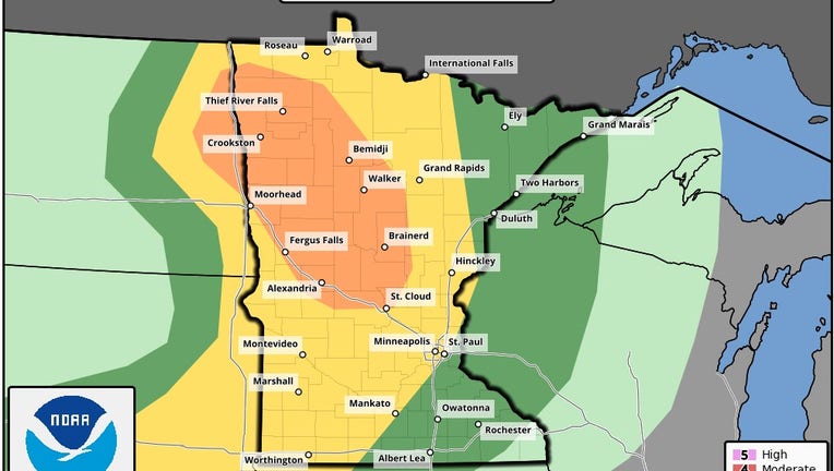
NOAA released a map showing the level of severe weather potential for Monday late afternoon through the evening. (NOAA)
(FOX 9) - The potential for severe weather exists for a large portion of Minnesota Monday evening with the highest probability of severe storms to the northwest of the Twin Cities.
Storms are expected to develop late in the afternoon along the Red River near the Minnesota & North Dakota border. The storms could strengthen and expand as they head east and southeast over time. If these storms hold together long enough to get to the Twin Cities metro, it likely wouldn’t be until after 10 p.m with some lingering strong storms possible overnight as well.
The FOX 9 Weather team will be monitoring the storms this evening. This will be updated as more information becomes available.