

More active weather pattern likely on the way
(FOX 9) - Since our dash a day snow from nearly three weeks ago, it’s been very quiet around here. Because of that tranquility, we were stuck with cloudy skies for just under 11 consecutive days--one of the longest stretches of cloudy weather in years.
But now that we are onto a more progressive pattern, we’ve seen the sun return. The downside to that, however, is when conditions line up, we can get into a much stormier pattern…and it looks like we might be heading in that direction.
While snow is far from certain, especially further down the line you go, it appears our tranquility is about to end with at least a couple different chances for precipitation over the next few days.
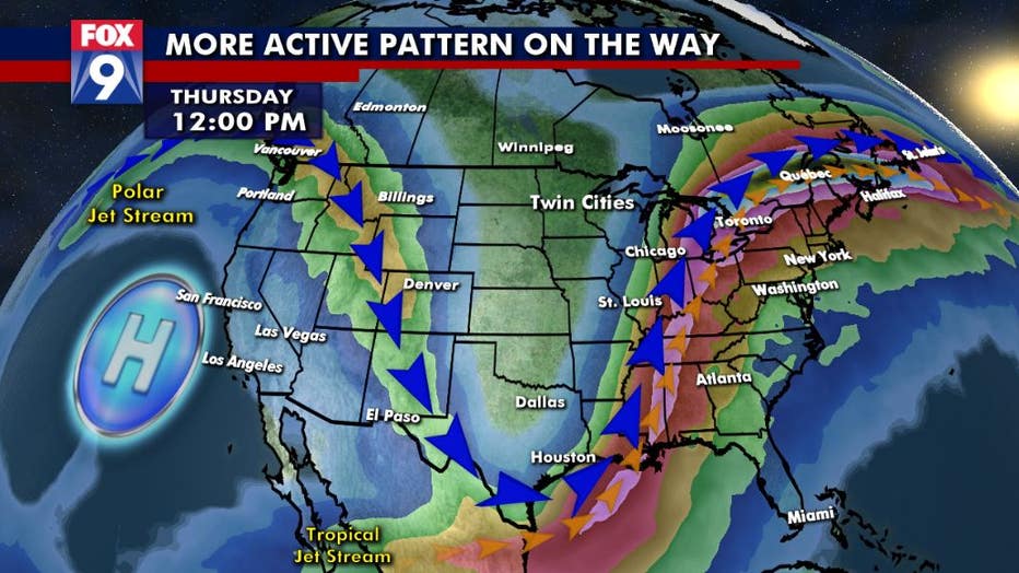
Our pattern begins with a giant high pressure off the coast of California, leading to a weather blockade in the eastern Pacific and western U.S. This type of pattern often sends the moisture up and over us with the jet stream or, in many other cases, keeps that moisture contained to our south and east much like what has happened with the major storm playing out in the southern Plains and the East Coast over the last 48 hours.
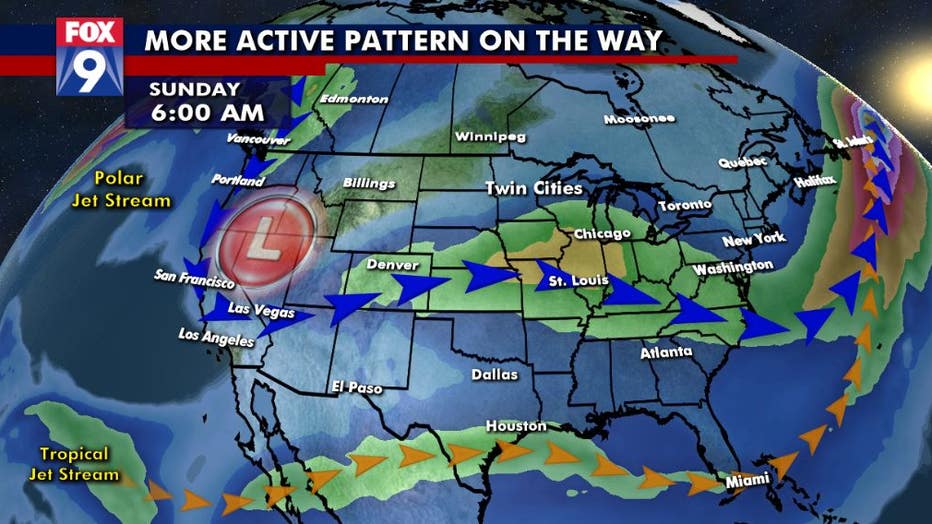
But by the weekend, that ridge of high pressure in the eastern Pacific breaks down, allowing for a dip in the jet stream in the West. This allows storms to begin diving further into the West Coast. North America’s upper level pattern and storm track is from west to east, so with a dip further to the south as storms roll into the central Rockies, those storms have the potential to head our way. Not to mention, as the storm track dips southward, it can pick up more moisture with the advection of the tropical jet stream. This brings in moisture from the Pacific and the Atlantic Oceans that can then spread across the country.
It’s when this tropical jet heads northward that much of the moisture in the Lower 48 falls as precipitation throughout the winter. That may occur by the latter half of the weekend as moisture surges into the state.
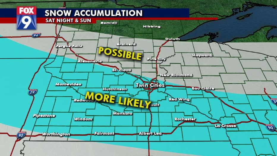
While some light flakes and extremely minimal accumulations are possible early Friday, a more legitimate and shovelable event is possible late Saturday and early Sunday. All of us currently have a shot at some snow this weekend, it will quite likely be a bit more of a narrower band than what we have been used to as of late, with the best chances for accumulating snow setting up in southern and central Minnesota. Some changes in exact location are still possible.
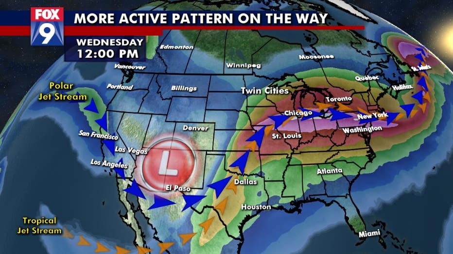
Once that chance goes by, there may be more next week as our tropical jet stream likely stays active over the U.S. leading to more precipitation chances nationwide.