

Minnesota weather: Tropical heat Tuesday before late day strong storms and heavy rain
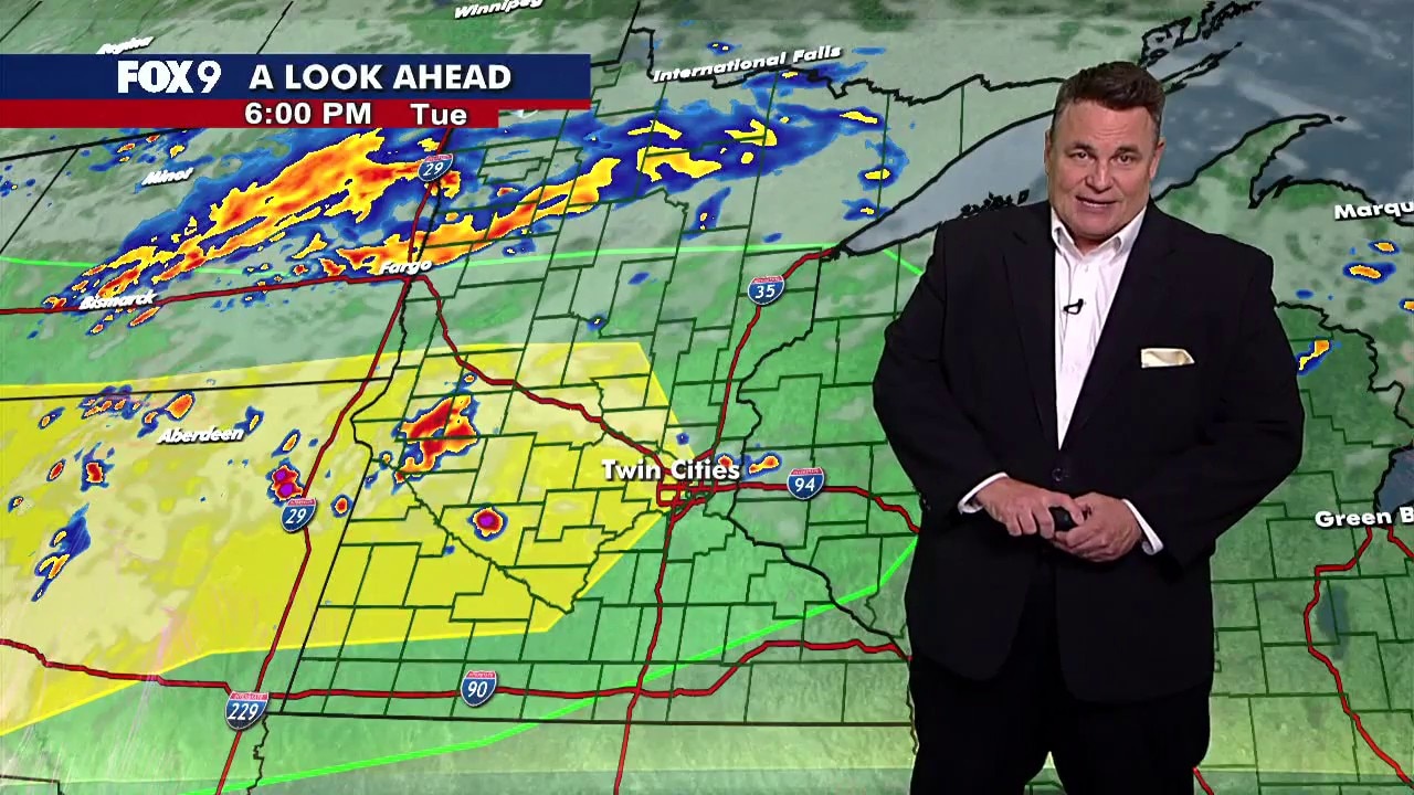
MN weather: Afternoon update on Tuesday storms
Storms are expected to move across parts of Minnesota on Tuesday evening and into the overnight hours. FOX 9 meteorologist Keith Marler has more on what to expect.
MINNEAPOLIS (FOX 9) - A hot and tropical Tuesday in Minnesota brings highs near 90 before storms and heavy rain develop late in the day.
Tuesday’s forecast in Minnesota
The forecast:
Tuesday starts quiet after overnight showers and storms swept across parts of Minnesota, bringing hail, gusty winds, and reported tornadoes.
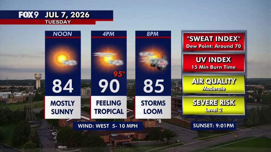
Temperatures rebound to around 90 degrees under mostly sunny skies, making for another hot and steamy afternoon. Light westerly winds at 5 to 10 mph continue before storms redevelop late in the day and become more widespread around sunset as a cold front approaches.
Tuesday night stays warm and muggy, with lows only falling to around 72 degrees.
(FOX 9)
Severe storm chances Tuesday
What to expect:
Scattered thunderstorms are expected to develop across western Minnesota this evening before moving east into the Twin Cities and western Wisconsin.
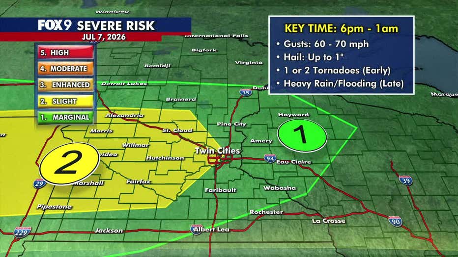
The Twin Cities metro and areas to the west remain under a level 2 slight risk for severe weather. Storms are expected between 6 p.m. and 1 a.m., with the primary threat being damaging wind gusts between 60–70 mph.
Large hail up to 1 inch in diameter is also possible, along with one or two brief tornadoes, especially with the initial storms near the North Dakota and South Dakota border.
As storms move farther east and become more widespread, the severe weather threat gradually shifts to heavy rain and localized flooding overnight. A band of heavier rain is expected to develop from the Interstate 94 corridor north into central Minnesota, where repeated rounds of rain could lead to flooding concerns into Wednesday morning.
(FOX 9)
Extended Minnesota weather forecast
What's next:
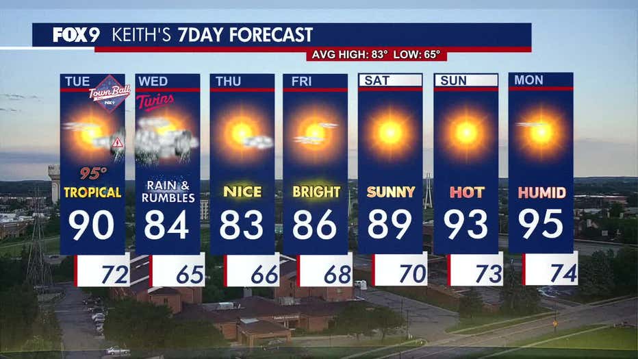
Wednesday remains very humid despite slightly cooler temperatures, with highs around 84 degrees. Morning rain gradually tapers before isolated storms redevelop during the afternoon and evening.
Thursday and Friday look beautiful, with sunshine, comfortable humidity, and seasonable temperatures.
The heat quickly builds again over the weekend, with highs climbing back toward 90 degrees Saturday and Sunday. Another stretch of hot, humid weather is expected early next week.
Here's a look at the seven-day forecast:
(FOX 9)
NWS investigating suspected tornadoes in Detroit Lakes area
Big picture view:
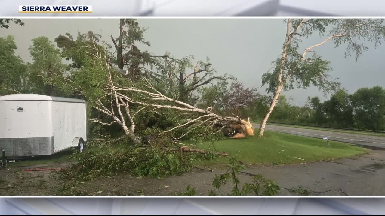
Suspected tornado causes damage, injuries in Becker Co.
Several tornadoes were reported in northwestern Minnesota on Monday night as severe storms rolled across the state. The Becker County Sheriff’s Office said a suspected tornado injured two people near Floyd Lake and left a trail of damage. FOX 9's Bill Keller has the latest.
The National Weather Service out of Grand Forks is sending a crew to the Detroit Lakes area Tuesday to survey the damage left by strong storms and suspected tornadoes Monday night.
Two people were injured when a suspected tornado struck the west side of Floyd Lake just north of Detroit Lakes on Monday evening. The tornado left significant damage, including damage to homes and properties, downed trees and downed power lines throughout the area.
The NWS will work with Becker County Emergency Management to confirm the touchdown and determine the path and strength of any suspected tornadoes.
The Source: This story uses information from FOX 9 meteorologists, the National Weather Service and the Becker County Sheriff's Office.