

Tornado in Becker County injures 3 people, causes significant damage

AERIALS: Tornado near Floyd Lake causes widespread damage
Sky FOX 9 captured aerial footage Tuesday of the aftermath after a confirmed tornado hit Floyd Lake, north of Detroit Lakes, Monday night. Three people were injured, and the twister damaged homes, brought down power lines and flipped over boats.
DETROIT LAKES, Minn. (FOX 9) - A tornado touched down near Detroit Lakes Monday evening, injuring three people and leaving behind damaged homes, uprooted trees and downed power lines after severe storms swept across northern Minnesota.
Tornado injures 3 people in Becker County
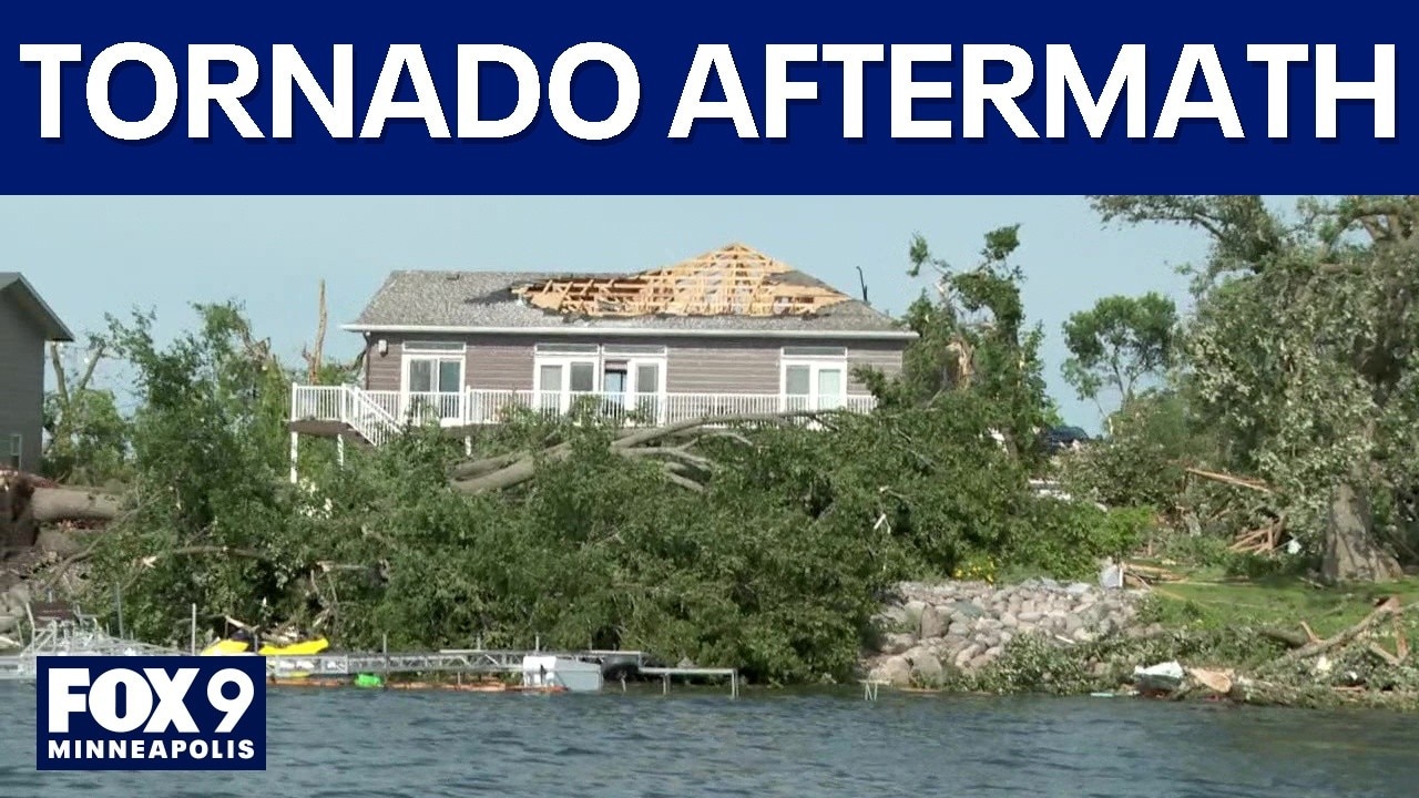
Minnesota weather: Day after tornado damage recap
FOX 9’s team coverage surveys some of the damage and cleanup efforts underway in northern Minnesota after a tornado was spotted Monday evening.
What we know:
The tornado touched down around 8:14 p.m. in the Oakland Beach area of Floyd Lake, according to the Becker County Sheriff's Office. Deputies and emergency responders went door-to-door through the damaged neighborhood searching for injured residents after receiving reports of extensive storm damage.
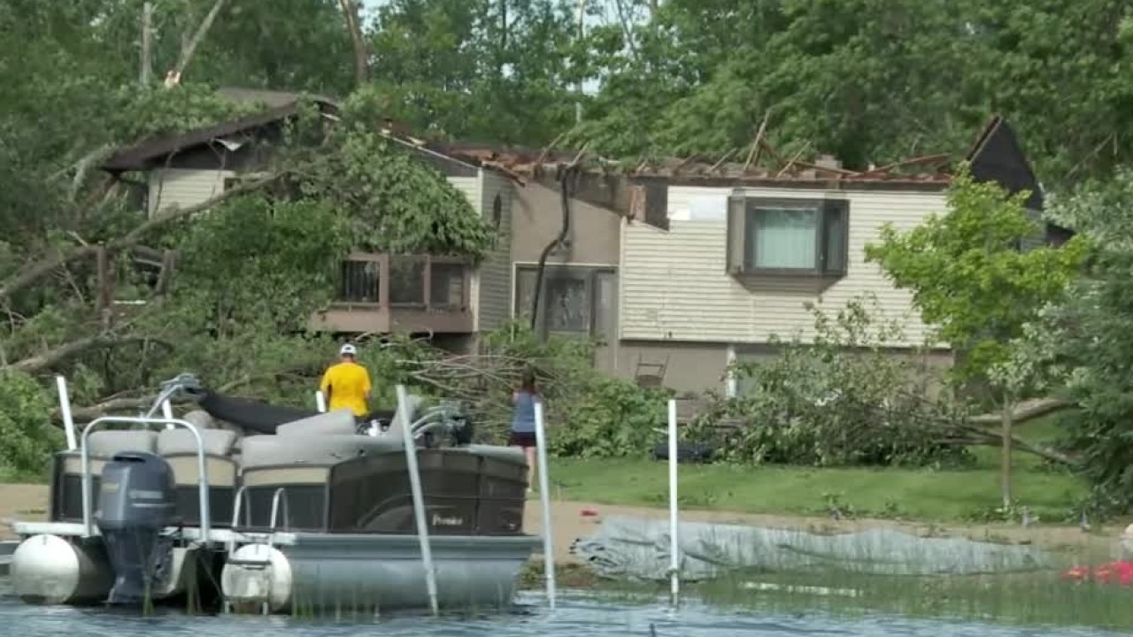
Storm damage update from Becker County officials
Becker County officials provided an update on the damage left behind by Monday's severe storms, including reports of a tornado.

Floyd Lake tornado: Drone video captures storm damage
Residents of Floyd Lake, near Detroit Lakes, spent most of Tuesday cleaning up after a tornado ripped through the area Monday night. Houses were damaged, some sheds were destroyed, power lines were brought down and boats and docks were damaged. Brian Merritt, the "Loans & Drones Guy," captured this damage.
Two people were taken to the hospital with non-life-threatening injuries, while a third person went to the hospital in a private vehicle, authorities said.
The tornado left signigicant damage, which emergency responders are still assessing. Authorities say there have been impacts to homes and other properties, numerous downed trees, and downed power lines throughout the area.
Power outages have steadily improved since the storm. More than 2,000 customers in Becker County were without electricity overnight, but that number had dropped to just over 500 by Tuesday morning as crews worked around the clock to restore service.
Emergency shelter for displaced residents
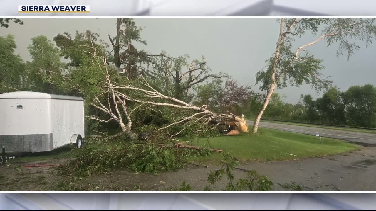
Suspected tornado causes damage, injuries in Becker Co.
Several tornadoes were reported in northwestern Minnesota on Monday night as severe storms rolled across the state. The Becker County Sheriff’s Office said a suspected tornado injured two people near Floyd Lake and left a trail of damage. FOX 9's Bill Keller has the latest.
What you can do:
The sheriff's office is urging the public to avoid the Floyd Lake area while emergency crews assess damage and restore services. An emergency shelter has been opened at M State College on Highway 34 for displaced residents and anyone needing assistance. Thirty-one residents have been assisted through the county's Emergency Operations Center as of Tuesday afternoon.
The sheriff's office said only residents and people associated with the property owners are currently being allowed into the damaged area and deputies are controlling access "to protect property and ensure the safety of homeowners, utility crews, and first responders," the sheriff's office said.
Officials have also opened the Becker County landfill to accept demolition debris and tree waste, while the Detroit Lakes compost site is accepting smaller tree debris.
NWS surveying tornado damage
Dig deeper:
The National Weather Service out of Grand Forks sent a crew to the Detroit Lakes area to survey the damage. They were working with Becker County Emergency Management to confirm the touchdown and determine the path and strength of any suspected tornadoes.
In a press conference on Tuesday, the Becker County Sheriff's Office said the NWS confirmed the incident was a result of a tornado.
Emergency officials said they will continue to provide updates as more information becomes available.
Other reported tornadoes, damage in Minnesota

Severe storms leave damage across northern MN
Severe storms swept across northern Minnesota Monday evening, leaving behind significant damage and multiple reports of possible tornadoes. FOX 9's Bill Keller has the latest.
The backstory:
Severe storms swept across northern Minnesota, leaving behind widespread damage, and reports of tornadoes, golf ball sized hail, and winds between 70 and 80 mph.
Four tornadoes were reported by trained weather spotters north of Detroit Lakes on Monday. Weather chasers described seeing buildings with roofs torn off, power poles knocked over and debris scattered across roadways. Photos sent in by FOX 9 viewers show trees toppled, roofs ripped off homes and buildings, power lines down and boats and docks overturned in the water.
A law enforcement officer in Kittson County reported a suspected tornado that flipped a trailer as it was pulling into a service station. In Grant County, a storm chaser saw a suspected twister on the ground near Herman for about two minutes.
The most intense storms were in northwest Minnesota, but the Twin Cities metro saw some rain, thunder and lightning in the overnight hours.
More severe storm chances on Tuesday
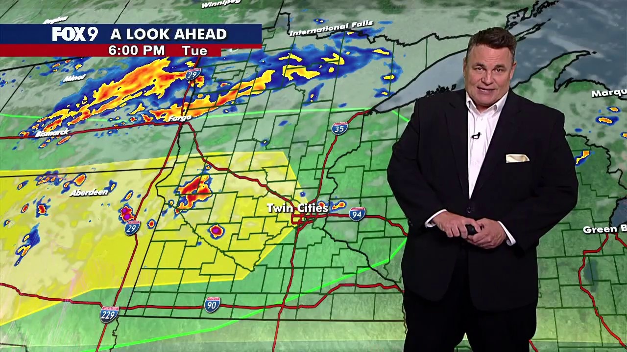
MN weather: Afternoon update on Tuesday storms
Storms are expected to move across parts of Minnesota on Tuesday evening and into the overnight hours. FOX 9 meteorologist Keith Marler has more on what to expect.
What to expect:
Scattered thunderstorms are expected to develop across western Minnesota this evening before moving east into the Twin Cities and western Wisconsin.
The Twin Cities metro and areas to the west remain under a level 2 slight risk for severe weather. Storms are expected between 6 p.m. and 1 a.m., with the primary threat being damaging wind gusts between 60–70 mph.
Large hail up to 1 inch in diameter is also possible, along with one or two brief tornadoes, especially with the initial storms near the North Dakota and South Dakota border.
As storms move farther east and become more widespread, the severe weather threat gradually shifts to heavy rain and localized flooding overnight. A band of heavier rain is expected to develop from the Interstate 94 corridor north into central Minnesota, where repeated rounds of rain could lead to flooding concerns into Wednesday morning.
The Source: This story uses information from the Becker County Sheriff's Office and previous FOX 9 reporting.