

Rain totals: Cold front brings 1-3 inches to parts of Minnesota, including NW metro
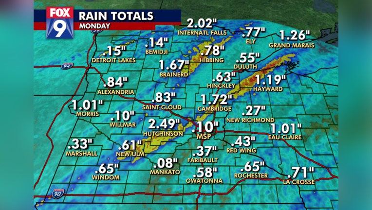
Rain totals across Minnesota on Monday, Sept. 20. (FOX 9)
(FOX 9) - Monday started out feeling like fall and by the afternoon it felt like fall thanks to a cold front, which also brought some decent rain and strong storms to parts of Minnesota and western Wisconsin.
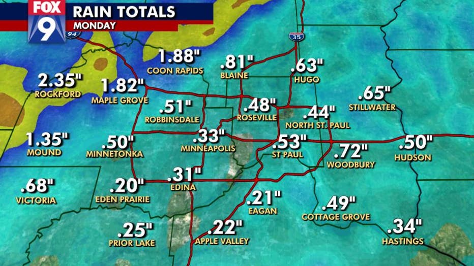
Rain totals in the Twin Cities metro on Monday, Sept. 20. (FOX 9)
Numbers were all over the board, but two swaths of heavier rain led to 1-3 inches of rain or more from around Redwood Falls area to the northwestern Twin Cities metro and from Little Falls to International Falls.
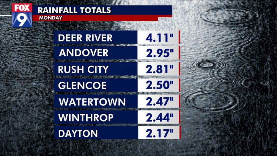
Rain totals for Monday, Sept. 20. (FOX 9)
The Minneapolis-St. Paul Airport recorded only 0.10 inches.
- Deer River: 4.11 inches
- Andover: 2.95 inches
- Rush City: 2.81 inches
- Glencoe: 2.50 inches
- Hutchinson: 2.49 inches
- Watertown: 2.47 inches
- Winthrop: 2.44 inches
- Dayton: 2.17 inches
- International Falls: 2.02 inches
- Cambridge: 1.72 inches
- Brainerd: 1.67 inches
- Eau Claire, Wisconsin: 1.01 inches
- St. Cloud: 0.83 inches
- Rochester: 0.65 inches
- MSP Airport: 0.10 inches
Tuesday will start out seasonable, but it will feel cool because of how much colder it is than Monday morning, down 10-25 degrees statewide. The last official day of summer will certainly feel more like fall with a northwestern breeze and temperatures topping out in the mid-60s.
Get the FOX 9 Weather App to track storms live on your phone, with future radar, live streaming video of FOX 9 coverage and alerts and forecasts customized for your current location and favorite locations. Download it for Android or Apple.