

Minnesota weather: Mild temperatures return, chance of showers and light snow midweek

MN weather: Mild temps return, snow chance this week
Sunday is climbing out of the cold snap, with temperatures warming today and tomorrow. FOX 9 meteorologist Jared Piepenburg has the full forecast.
MINNEAPOLIS (FOX 9) - We climb out of the quick cool snap we had to start out the weekend. Temperatures warm nicely into the 40s today and then 50s for Monday.
A low pressure system brings a chance of showers and then light snow midweek with above-average temperatures still around later in the week.
Sunday and Monday
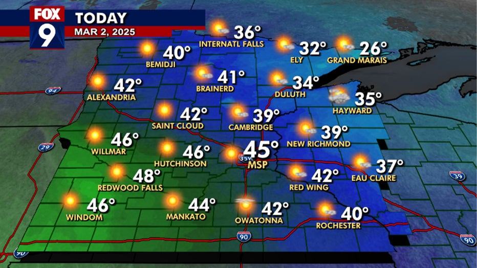
FOX 9 weather forecast. (FOX 9)
What to expect:
Winds switch to the south today with a few gusts in southern Minnesota topping off at over 20 mph.
The rest of the area will have a mild afternoon with plenty of sunshine and highs in the 40s.
Temperatures will be warmer for the bus stop forecast on Monday morning.
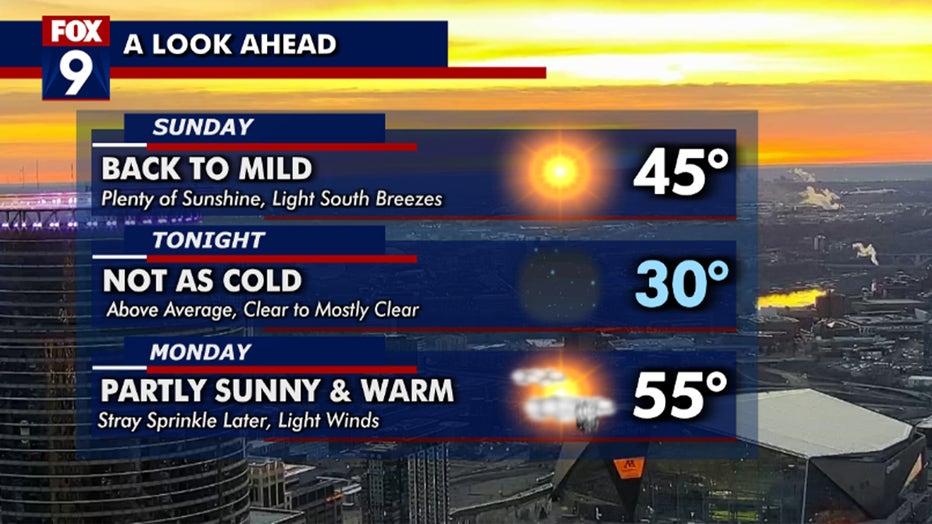
FOX 9 weather forecast. (FOX 9)
We drop just below freezing tonight with a nice climb into the 50s on Monday afternoon.
A few sprinkles can’t be ruled out later in the day. Winds stay light tomorrow too, making for a very pleasant start to the work week.
Work week outlook
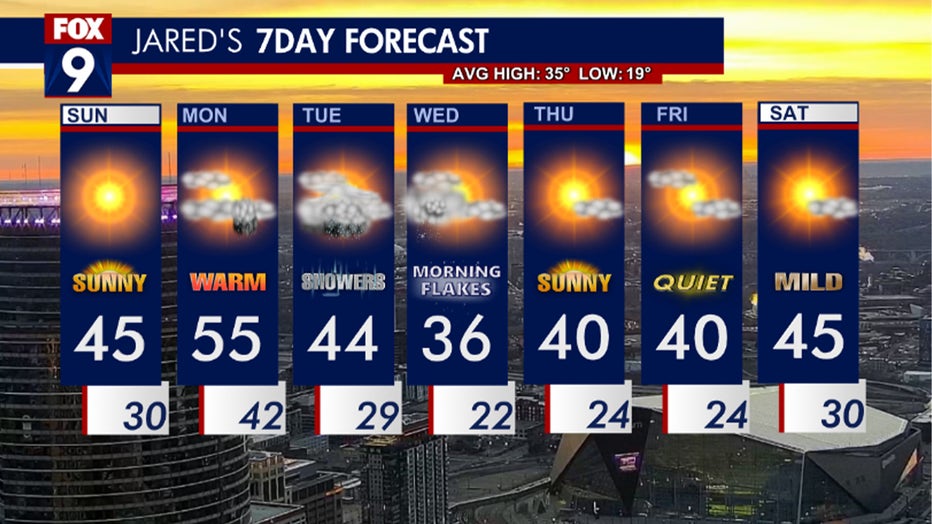
FOX 9 weather forecast. (FOX 9)
What we're seeing:
A low-pressure system is expected to slide through the region on Tuesday into Wednesday.
We start off with a chance of showers on Tuesday.
The showers look to stay fairly light and scattered throughout the area.
Tuesday’s temperature trend looks to stay steady nearly all day, with the morning starting in the mid-40s and closing out the afternoon in the mid-40s.
Temperatures cool down on Tuesday night and Wednesday morning, leading to some of the rain turning to a mix and then snow showers.
There is the possibility of some light accumulations for us on Wednesday before this low-pressure system pushes east, and we finish out the day with decreasing clouds.
Thursday through Saturday is looking quiet and stable with temperatures a little above average.
The Source: FOX 9 meteorologist Jared Piepenburg.