

Minnesota weather: Scattered storms Thursday afternoon with warm, humid conditions
MN weather: Scattered storms on Thursday
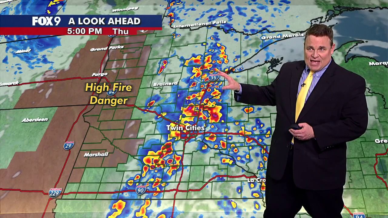
A cold front will likely trigger scattered storms and showers across Minnesota on Thursday afternoon. The Twin Cities metro area is under a level 2 slight risk of severe weather.
MINNEAPOLIS (FOX 9) - A warm and humid Thursday sets the stage for scattered afternoon storms across much of Minnesota.
Scattered storms Thursday in Minnesota
The forecast:
Thursday starts warm and humid under fairly cloudy skies. Temperatures climb into the low to mid-70s in the Twin Cities metro, with 80s possible across western Minnesota.

Storm chances:
A cold front moving through will likely trigger scattered showers and thunderstorms. The best chance for storms runs from early afternoon into the evening hours.
Isolated storms begin to fire up not long after the lunch hour. These first storm cells will hold a short-lived hail threat. But as storms become more widespread, they'll congeal into small lines and clusters that will switch the main severe threat to gusty winds and a very small chance of a tornado.
There is a large amount of moisture in the atmosphere for this time of year, so some very heavy downpours will accompany the strongest storms that could lead to some minor and short-lived street flooding.
The metro and areas to the south are under a level 2 slight risk of severe weather. Much of central and northern Minnesota is under a level 1 marginal risk. The main threats include brief heavy downpours, gusty winds over 60 mph and possible hail. An isolated tornado also can’t be ruled out.
Showers may linger into the evening, but the severe weather threat will likely diminish after sunset. Overnight lows will drop into the 40s.

(FOX 9)
Extended Minnesota weather forecast
What's next:
The cold front will shift winds from the north, causing temperatures and dew points to drop. Friday will bring sunshine and seasonable temperatures in the lower 60s.
Saturday stays quiet overall with more clouds and temperatures around 60 degrees. Sunday trends a little warmer as highs reach the mid to upper 60s under brighter skies.
Rain chances return Monday, with temperatures holding in the upper 50s through the early part of next week.
Here's a look at the seven-day forecast:

(FOX 9)
The Source: This forecast uses information from FOX 9 meteorologists.