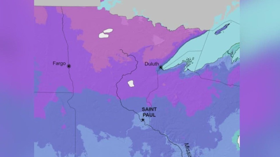
Minnesota's plant hardiness zones have changed

Plant hardiness zone map updated.
The U.S. Department of Agriculture has updated its plant hardiness zone map. FOX 9's Rose Schmidt reports.
MINNEAPOLIS (FOX 9) - The U.S. Department of Agriculture this week unveiled an updated plant hardiness zone map — the first update since 2012 — which has changed the hardiness zones for much of Minnesota.
The map is a valuable tool for gardeners and growers because it shows which plants are most likely to thrive where you live. This updated map is more accurate and more detailed than prior versions, which were done in 2012 and 1990, the USDA says. The map is based on 30-year averages of the lowest annual winter temperatures at specific locations and is divided into 10-degree zones and 5-degree zones. This year's map incorporates data from 13,412 weather stations, while the 2012 map used 7,983 stations, a press release notes.
"These updates reflect our ongoing commitment to ensuring the Plant Hardiness Zone Map remains a premier source of information that gardeners, growers and researchers alike can use, whether they’re located in the continental United States, Alaska, Hawaii or Puerto Rico," ARS Administrator Dr. Simon Liu said in a press release.
Each zone is broken into half zones, designated as "A" and "B." When compared to 2012, the USDA's 2023 map shows about half the country shifted to the next warmer half zone, and the other half of the country remained in the same half zone. The USDA explains that the shift to the next warmer half zone means those areas warmed somewhere in the range of 0-5 degrees (some locations also warmed by 0-5 degrees but didn't move zones).
What USDA hardiness zone is Minnesota?
For Minnesota, most spots in the state have increased at least a half category, with portions of the Twin Cities metro now in Zone 5a, up from Zone 4b. The map for Minnesota is available here (and above). Here are the previous hardiness zone maps:
Why are hardiness zones changing?
The shifts in zones in the 2023 map are mostly due to the USDA incorporating temperature data from a more recent time period, with the USDA noting the 2023 map includes data measured at weather stations from 1991-2020.
"Temperature updates to plant hardiness zones are not necessarily reflective of global climate change because of the highly variable nature of the extreme minimum temperature of the year, as well as the use of increasingly sophisticated mapping methods and the inclusion of data from more weather stations," the USDA's press release said. "Consequently, map developers involved in the project cautioned against attributing temperature updates made to some zones as reliable and accurate indicators of global climate change (which is usually based on trends in overall average temperatures recorded over long time periods)."
Tips for gardeners and growers
The USDA says about 80 million gardeners and growers in the United States represent the most frequent users of the hardiness map. In addition to updating the maps, the USDA's website also includes tips for growers.

