

MN weather: Severe storms possible in MN Wednesday afternoon
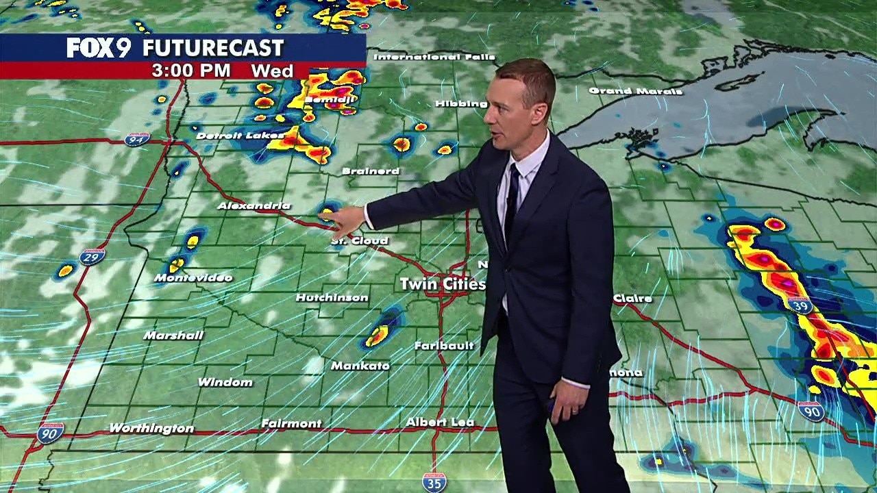
MN weather: Tracking severe storms Wednesday afternoon
Jared Piepenburg is tracking severe storms that could move through Minnesota in the afternoon hours on Wednesday.
MINNEAPOLIS (FOX 9) - After overnight thunderstorms exit Minnesota early Wednesday morning, the atmosphere will recharge for another round of potentially severe storms this afternoon and evening.
Severe Thunderstorm Watch issued for SE Minnesota, much of Wisconsin
Big picture view:
The National Weather Service has issued a Severe Thunderstorm watch for parts of Minnesota, Wisconsin, and Iowa.
The watch covers only far southeastern Minnesota, including Fillmore, Goodhue, Houston, Olmsted, Wabasha, and Winona counties. However, in Wisconsin, the watch covers most of the state except for some northern counties.
In Iowa, the watch covers eastern counties along the Wisconsin and Illinois border.
The watch is in effect until 7 p.m. Wednesday evening.
Wednesday's forecast in Minnesota
The forecast:
Overnight storms are winding down Wednesday morning after bringing heavy rain, strong winds, lightning, and power outages to parts of Minnesota.
The Twin Cities metro should stay quiet through the mid-morning before storm chances return. Temperatures quickly rebound into the upper 80s, with heat index values reaching the mid-90s.
After sunset, storms gradually diminish and overnight lows fall into the mid-60s.
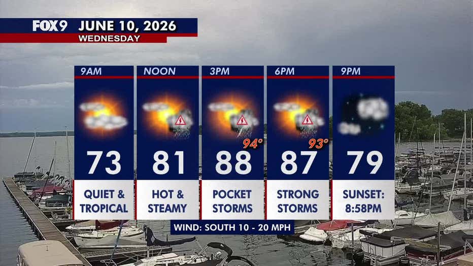
(FOX 9)
More severe storms possible Wednesday
What to expect:
As the atmosphere recharges, storms are expected to redevelop from late morning through the afternoon and evening. Exactly where storms form remains uncertain, but some storms could be severe.
These storms carry a level 3 enhanced risk of severe weather for eastern Minnesota and western Wisconsin, extending into eastern Iowa and northern Illinois. Central Minnesota remains under a level 2 slight risk, while western Minnesota is under a level 1 marginal risk.
The latest round of storms could develop between 11 a.m. and 7 p.m. Wednesday. All severe weather hazards are possible, including baseball-size hail, damaging winds, and tornadoes.
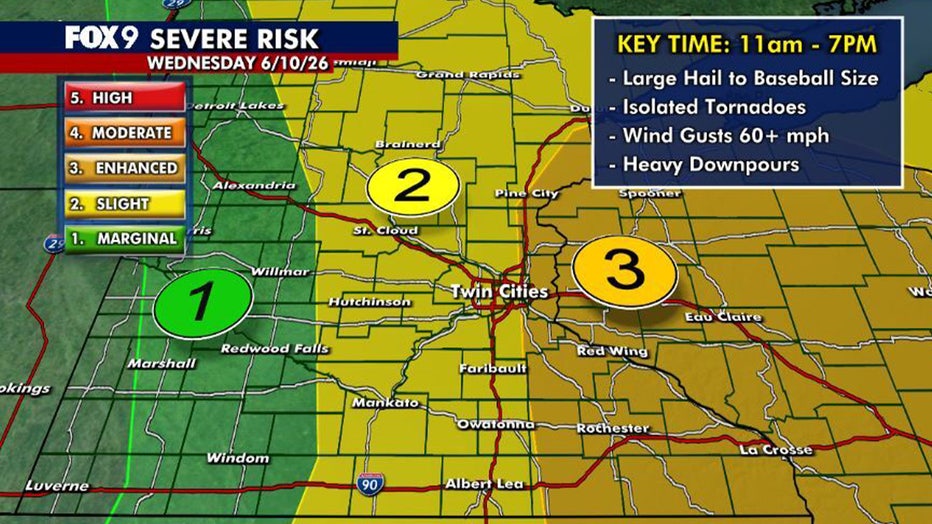
(FOX 9)
Extended Minnesota weather forecast
What's next:
Thursday turns cooler, with highs settling into the mid-70s. A few scattered showers remain possible, along with occasional breaks of sunshine.
Temperatures rebound into the low 80s Friday before another cold front approaches late in the day. A stray storm cannot be ruled out.
The weekend looks much more comfortable, with sunshine and highs in the mid-70s.
Here's a look at the seven-day forecast:
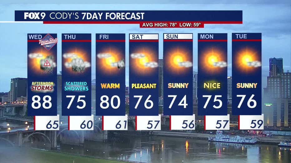
(FOX 9)
The Source: This story uses information from FOX 9 meteorologists.