

MN weather: Rain clears Tuesday morning ahead of potential for storms on Wednesday
MN weather: Rain clears on Tuesday, storms risk Wednesday
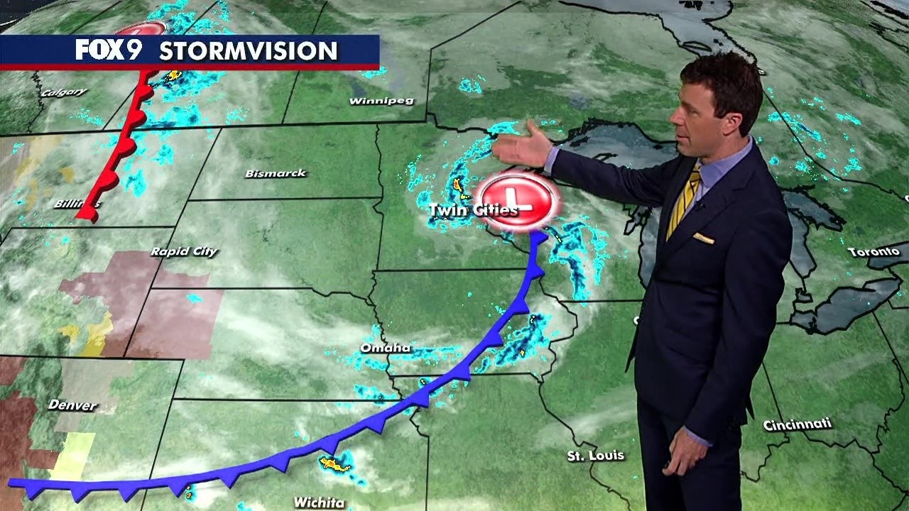
The Twin Cities will see midday sunshine and a high of 73 on Tuesday, before the potential for scattered thunderstorms on Wednesday. Cody Matz has your forecast.
(FOX 9) - Clouds will clear as we head into midday on Tuesday ahead of the potential for some storms on Wednesday in Minnesota.
Tuesday forecast
What we know:
The low pressure will scoot by fast on Tuesday morning, so we'll see plenty of midday and afternoon sunshine.
Temperatures are back in the low 70s for most areas, reaching 73 in the Twin Cities.
The next system starts to approach this evening, bringing increasing clouds towards the sunset hour.
Showers arriving in western Minnesota will fan out and spread.
Tuesday night:
Showers will spread across the area from west to east. Overnight lows will be in the mid to upper 50s.
Storms possible on Wednesday
What's next:
A system that is essentially an Alberta Clipper in the summer season will bring the potential for severe weather.
The bulk of the system will stay south and east, bringing a level four risk for Wednesday for sections of Illinois and Indiana.
If we manage to get sun and some clearing, we could tap into a level two risk in parts of southeastern Minnesota.
Big picture view:
Tuesday night through early Wednesday will likely be a wet day across portions of northern Minnesota.
Areas north of I-94 will see a soaking event throughout the day on Wednesday.
It will probably not be wet in the Twin Cities; the area will be in and out of morning showers and there should be a solid lull. If that lull comes with sunshine and temperatures in the middle 70s, we could pop scattered thunderstorms.
Those could pack a punch with large hail potential.