

MN weather: Sunny, cool start to Monday but rain chances ahead
MN weather: Cool and sunny start for Monday but rain ahead
It will be a cool and sunny start to your Monday but there is some rain in the forecast. Cody Matz has a look at your forecast.
(FOX 9) - It will be a cool and sunny start to your Monday, but rain chances are ahead for the start of the week.
Cool temps in MN
Big picture view:
A secondary shot of cooler air will keep temperatures pleasant and below average through the week.
This is caused by an upper level low, the Hudson Bay Low, creating a Northwest pattern.
Local perspective:
Monday starts with sun, but high clouds will filter in from the north and west as the next wave slides through.
High level clouds will be on the increase through the midday and afternoon hours.
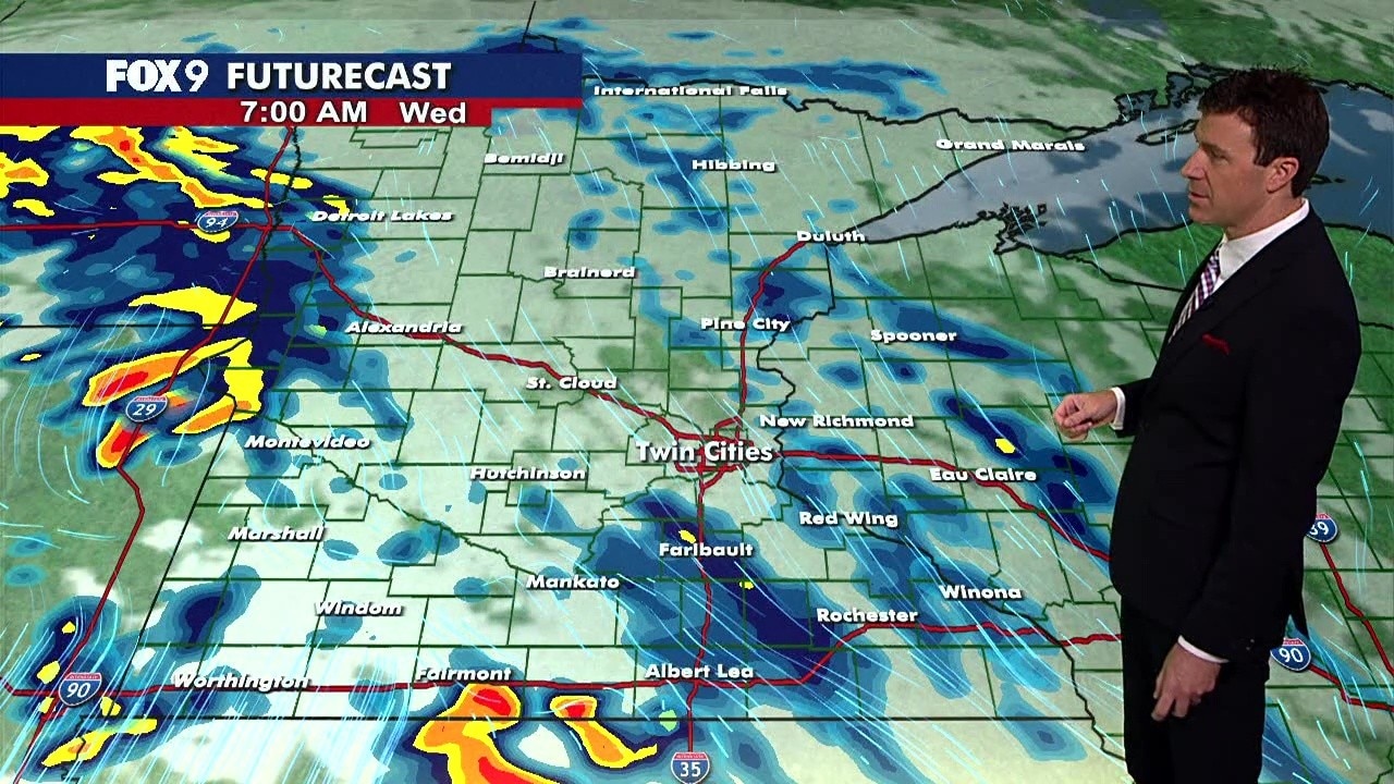
The wave will pop scattered showers and a couple of isolated thundershowers in northern and western Minnesota during the afternoon.
Rain chances hold off in the Metro until evening with showers rolling towards the Twin Cities around sunset, 8 p.m. or 9 p.m. Expect little downpours, a couple of possible lightning strikes, and gusty breezes from stronger cells.
Scattered showers will linger in the overnight hours, bringing lows in the low to middle 50s, and 54 in the Twin Cities.
Tuesday forecast:
Rain chances will hang around through the morning commute, then scoot eastward.
Conditions will become partly cloudy.
Tuesday afternoon will be cooler, with highs in the upper 60s and low 70s, hitting 73 in the Twin Cities.

(FOX 9)
Seven-day forecast
What's next:
Scattered thundershowers are possible again on Wednesday afternoon. After that, things are expected to be drier but temps in the 70s will hang around through the remainder of the week.