

Record cold possible Monday with some unusual lake effect snow
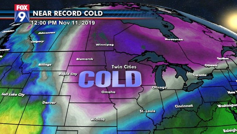
Large bubble of cold air sinking southward out of Canada to end the weekend and start our workweek
To say that the start of November has been cold is an understatement. Temperatures so far this month have been averaging nearly 9 degrees below average… and it’s about to get even colder. A true Arctic air mass will be pushing into the Upper Midwest on Sunday and will allow temperatures to plunge to levels rarely seen in the first half of the month. Potentially cold enough to set some record cold high temperatures.
With the colder air will come some wind as well, dropping wind chills below zero at times and giving us the coldest day we’ve seen since February.
With the cold air coming so early in the season, area lakes haven’t frozen yet. Because of this, lake effect snow will also be possible, but not just around the usual zones near Lake Superior. Now, don’t expect your neighborhood pond to produce any snow, as you have to have a large enough fetch of water for the atmosphere to build some clouds and drop some snow on the downwind shoreline. But several of Minnesota’s largest lakes will have the opportunity for some snow bands to develop on the south side of the lake. Mille Lacs, Lower Red, Winnibigoshish, Leech, & Lake of the Woods all have the opportunity to see some accumulating lake effect snow.
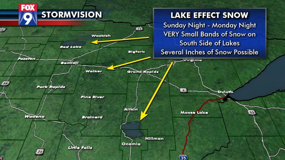
Larger Minnesota lakes from Lake of the Woods southeastward to Mille Lacs have the possibility of producing some accumulating lake effect snow. Even Lake Minnetonka could produce some lake effect snow flurries.
It’s not just Minnesota though that will be getting this brutally cold air mass. Most areas east of the Rockies will get a dose of cold that could produce hundreds of record cold high temperatures over the next few days.
An animation of forecast highs from Sunday through Thursday nationwide. Each temperature with a box around it indicates a forecast cold high temperature for that day. There could be hundreds over the next few days.
It could also produce some daily record lows overnight, as tweeted by the Weather Prediction Center…
Stay warm!