

MN weather: Potential for storms in western MN
MN weather: Potential for storms in western MN
It's shaping up for a quiet day in the Twin Cities metro but for western Minnesota and the Dakotas there a potential for some storm. Cody Matz has your forecast.
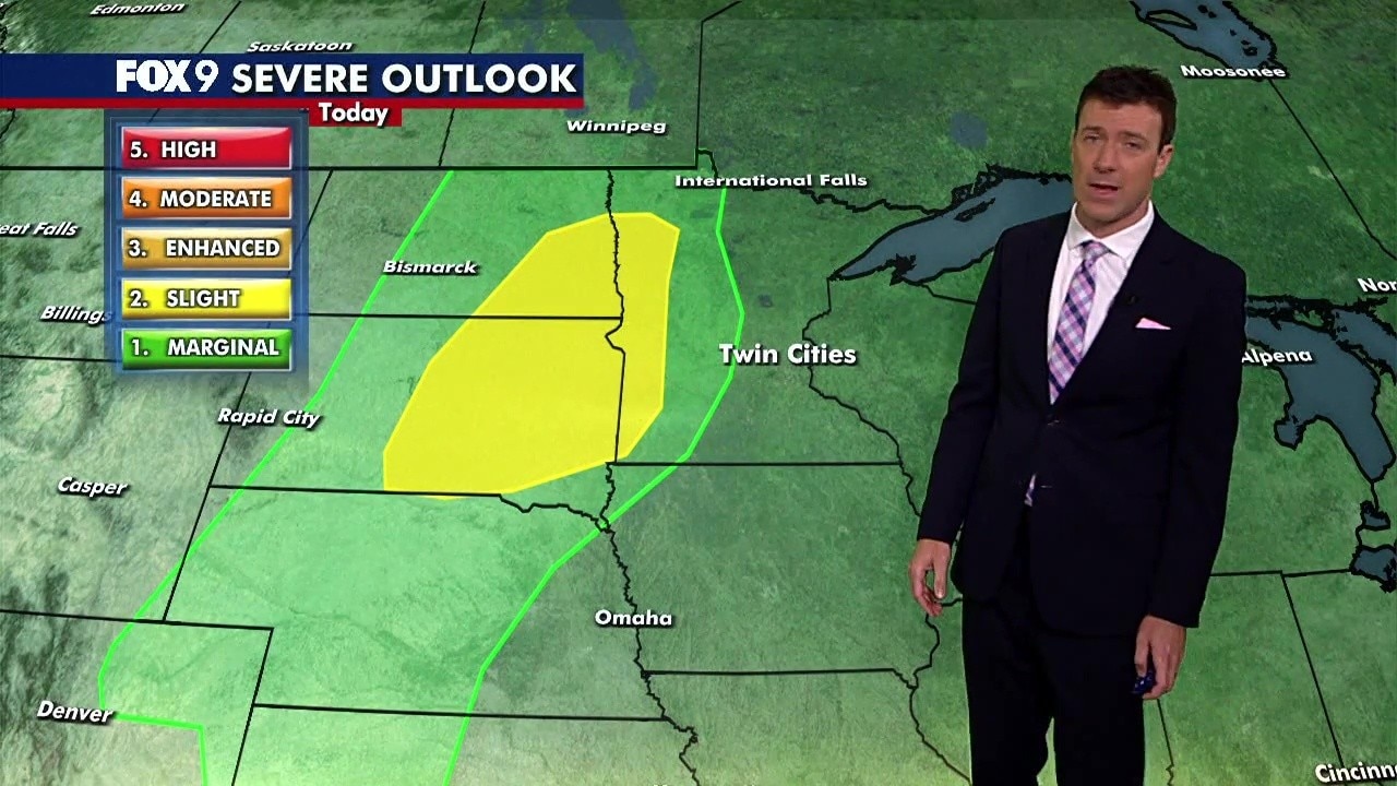
(FOX 9) - It will be another quiet day in the metro, but storms will be possible in far western Minnesota, which is under a slight risk of severe weather.
Tracking storms in western MN
What we know:
After some isolated and scattered storms in the morning hours, another round of storms is possible in the evening hours as a cold front rolls in.
This will be focused mostly across the Dakotas, as well as parts of far western Minnesota – especially the closer you get to the Dakotas border.
What's next:
The risk of storms will continue on Thursday and Friday and stretch into the metro on both days, with the potential of a level one risk.
We'll see how much of the remnants of the western storms can survive the drier air moving and roll into the metro Thursday morning. But we will wake up to some showers as we wake up on Thursday. Chances for storms return in the evening hours for central and southern Minnesota.
Seven-day forecast:
We will dry things up once we get past Friday, just in time for your weekend. It will be quite warm with highs in the middle 80s, and then we will certainly see summer-style heat and humidity next week, with a high of 85 on Monday and 86 on Tuesday.
