

Minnesota weather: Strong storms on Sunday, tornadoes possible in southwest MN
MN weather: Strong storms on Sunday, tornadoes possible in southwest MN
FOX 9 meteorologist Jared Piepenburg has the latest details on Sunday's severe weather forecast.
MINNEAPOLIS (FOX 9) - Stormy weather is on the way for Minnesota, with the potential for severe thunderstorms and tornadoes in southwest Minnesota.
Sunday forecast

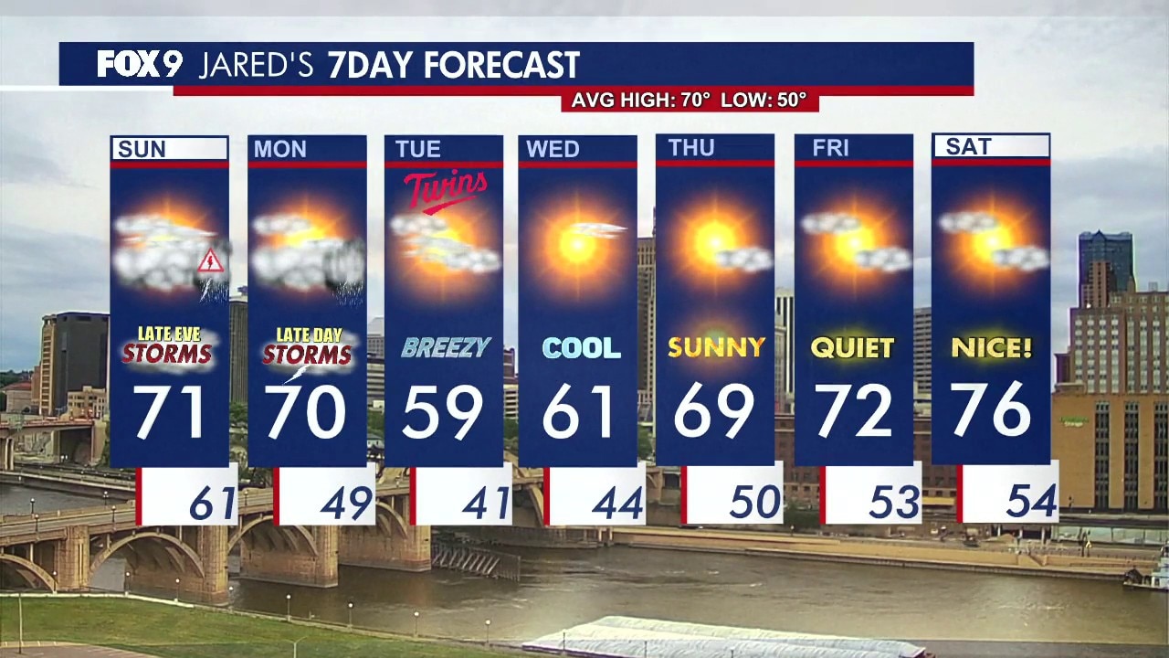
FOX 9 weather forecast. (FOX 9)
Local perspective:
Sunday started cloudy with a few early showers that fizzled out, but the real concern is for stronger storms developing later in the day.
Southwestern and southern Minnesota are in a level two to three risk zone for severe weather, with large hail and isolated tornadoes possible in the evening and overnight hours.
The Twin Cities and areas stretching toward western Wisconsin could see gusty winds and downpours as storms move through.
Winds will shift from east to southeast, increasing moisture and fueling storm development. Wildfires in the Brainerd Lakes and North Shore areas may benefit from expected rainfall.
The threat of severe weather will be highest during the early overnight hours, with storms clearing out by Monday morning.
Temperatures will top out near 70 degrees Sunday in the Metro, with a chance for it to feel humid late in the day. Monday will be similar, with storms possible late.
Extended forecast
What's next:
While most of Monday is expected to be dry, another round of rain and storms could arrive by evening and overnight.
The strongest storms Monday will be near the Iowa border and possibly southern Wisconsin, but parts of Minnesota could still see much-needed rain.
Tuesday will turn much cooler after the system moves through, with highs in the 50s for much of the state and even 40s in northern Minnesota.
After a cool stretch Tuesday and Wednesday, temperatures are expected to rebound.
Thursday could see highs near 70 and sunshine, with mostly quiet weather Friday and Saturday.
The Source: This story uses information from the FOX 9 weather forecast.