

Minnesota weather: Snowy for some, warmer weekend ahead

March 1 forecast: Morning snow, highs in the 30s
A burst of snow in the Twin Cities Wednesday morning, while central Minnesota will pick up a few inches of snow throughout the day. There are winter weather advisories and winter storm warnings in effect for portions of central and northern Minnesota.
MINNEAPOLIS (FOX 9) - It's a snowy Wednesday for central and northern Minnesota, while the Twin Cities saw some snowflakes, that'll clear out after the commute.
The high in the Twin Cities will be around 35 degrees on Wednesday, the first day of meteorological spring. A winter weather advisory is in effect for the Twin Cities through the morning commute due to snow globe-like snow.
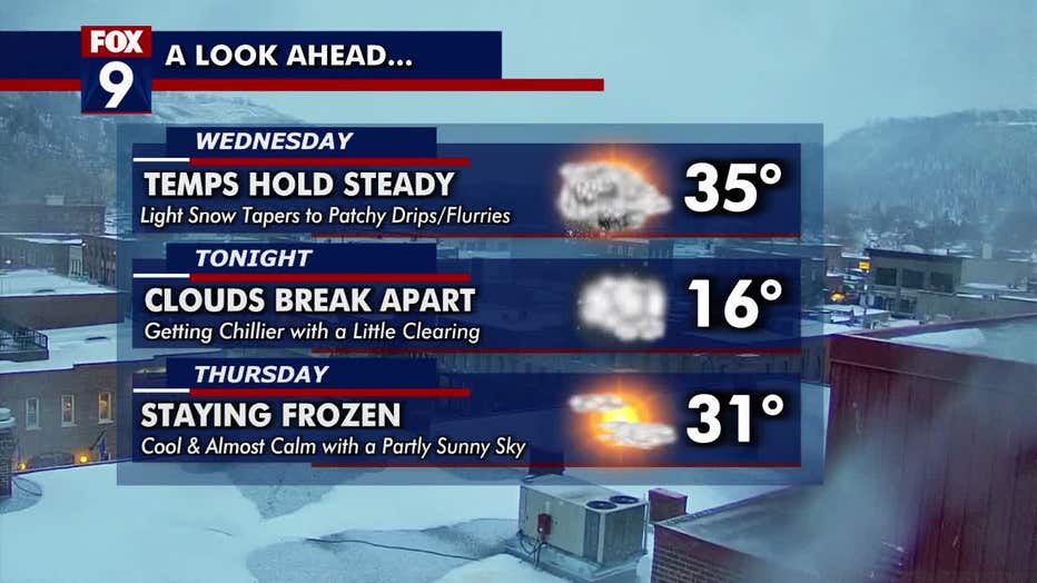
A look at the forecast.
The light snow in the Twin Cities will taper to patchy drips or flakes. Then clouds break apart Wednesday night. The low will dip to around 16 degrees.
Snow in central, northern Minnesota Wednesday
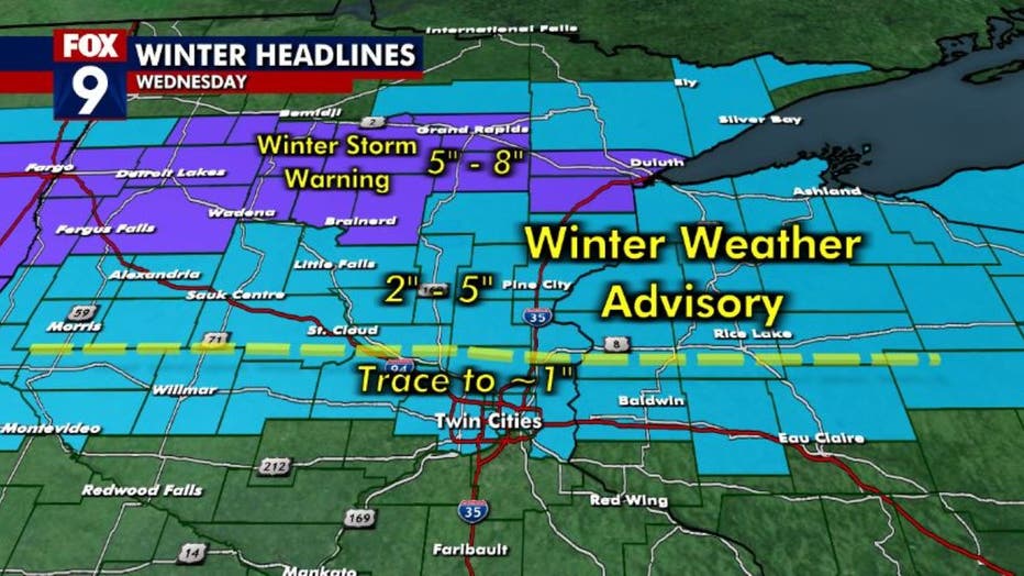
Winter weather advisory and winter storm warning for central and northern Minnesota. (FOX 9)
More snow is expected in central and northern Minnesota on Wednesday.
A winter weather advisory is in effect for central Minnesota, and a portion of northern Minnesota, which includes a swath from Duluth to Detroit Lakes, is under a winter storm warning. The winter weather advisory area could pick up 2-5 inches of snow, while the winter storm warning area could see 5-8 inches of snow.
The weather alerts start to expire around 3 p.m. but the area could see snow until about 6 p.m. Wednesday.
Warmer weekend ahead
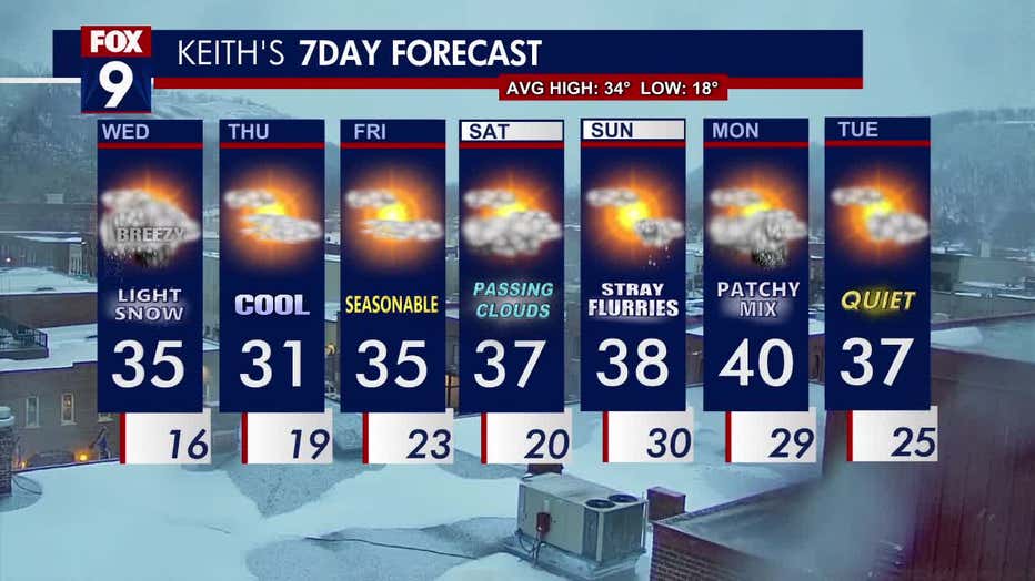
The seven-day forecast. (FOX 9)
It'll stay frozen on Thursday, with a partly sunny sky and a high of 31 degrees. Seasonable temperatures are in store on Friday, with a high of 35 degrees and some sunshine.
The weekend will be warmer with highs in the upper 30s. Saturday should see passing clouds and a high of 37 degrees. Sunday will see a high of 38 degrees and some stray flurries.
Looking ahead to Monday, there may be a patchy mix with highs around 40 degrees.
Tuesday is looking quiet, with a high of 37 degrees.
The average high for this time of year in the Twin Cities is 34 degrees. The average low is 18 degrees.