

Minnesota weather: Widespread soaking rain Friday with 2+ inches possible
MN weather: Quiet Thursday before soaking rain Friday
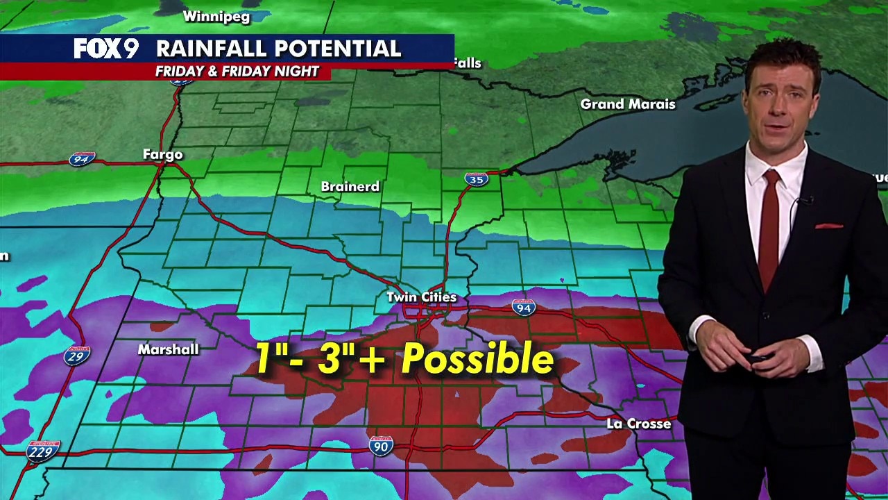
Overnight rain clears out for a mostly dry and fairly cloudy Thursday. A soaking rain system arrives Friday, with 1 to 3 inches of rain possible across parts of central and southern Minnesota. FOX 9 meteorologist Cody Matz has more on what to expect.
MINNEAPOLIS (FOX 9) - A widespread soaking rain is moving into Minnesota on Friday, with some areas potentially picking up 2 or more inches.
Why this system will bring heavy rain
Big picture view:
Friday has the highest potential for the most widespread beneficial rain much of the area has seen since late July. While nothing in life is a guarantee, a potent wave that has an origin from the eastern tropical Pacific Ocean will likely lead to a swath of heavier rain across the Upper Midwest from Thursday night to early Saturday. It's the tropical origin of this storm that gives it a lot of potential.
No two storm systems are the same, but they can certainly have similar characteristics and therefore similar results. The heaviest rainfall events here in Minnesota almost entirely come from storm systems that have quickly transported from the tropical locations of the Pacific and Atlantic oceans.
These storms aren't necessarily super strong or even the remnants of some official tropical storm or hurricane, but as these systems use the jet stream to rocket into the Upper Midwest, they bring most of their mid and upper-level moisture with them.
This waterlogs the atmosphere, which can set the stage for some very heavy rain. But it's not a guarantee, as you need something in the atmosphere to help wring out that moisture. Think of soaking a beach towel and holding over someone's head. It may drip a little, but that person doesn't get soaked until you ring out the towel.
How much rain could Minnesota get?
By the numbers:
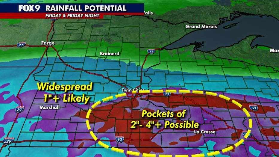
For the moment, a shield of steady rain is likely to move through, which should give a lot of central and southern Minnesota as well as western Wisconsin at least an inch of rain.
But where that shield lingers the longest, along with scattered thunderstorms that may form Friday evening and night, some pockets of 2 or even 3 inches will be possible. The area with the highest probability of the higher totals will be from the Twin Cities south and eastward.
(FOX 9)
How Wednesday's rain could help with flooding
Local perspective:
The rain Wednesday night may actually help Friday's rain soak in faster and more efficiently, potentially preventing any sort of flooding if very heavy rain does fall.
Warm, parched soils become compact and very dense and this can make it very difficult and slow for water to penetrate into the ground. But with some moisture already falling on Wednesday night over a few hours, that process has already begun to open the soil's "pores", which could and should lead to more efficient soaking with any and all rain on Friday.
Could this rain help drought conditions?
Dig deeper:
Most of the state is experiencing some level of drought, ranging from abnormally dry to extreme drought conditions, according to the Minnesota DNR's website.
Friday's rain could be vegetation saving moisture before heading into the dormant season, though it will not cure the drought entirely.
Drought can and often takes a long time to form and often takes an equally long time to disappear. But this will hopefully be a big step in the right direction.
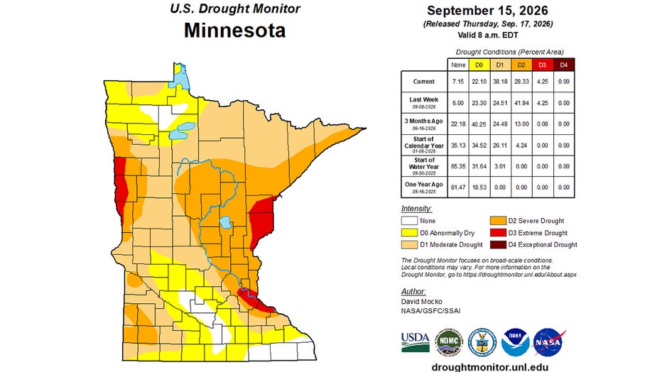
Minnesota DNR map of current drought conditions. (Supplied)
The Source: This story uses information from FOX 9 meteorologists.