

Freezing drizzle, some snow will make for messy weekend
The Twin Cities metro is in for a "longer duration, light precipitation" event this weekend.
(FOX 9) - It’ll be a bit of a mess in the Twin Cities weather-wise starting Friday night and taking us into Sunday. It’s what we call a "longer duration, light precipitation" event.
Patchy light freezing drizzle will start Friday night and continue into early Saturday before switching to light snow late Saturday through Sunday morning.
Most spots will get an icy glaze and up to 2 inches or so of snow. Parts of southeastern Minnesota may end up with a little more, but this will NOT be a big snow event for Minnesota.
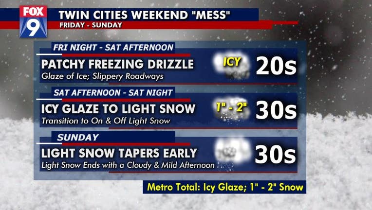
TIMELINE
Friday night - Saturday afternoon: Patchy freezing drizzle; glaze of ice; slippery road ways
Saturday afternoon – Saturday night: Icy glaze to light snow; transition to on and off snow
Sunday: Light snow tapers off early, ends with a cloudy and mild afternoon

FOX 9 Reporter Rob Olson surprised by speedy tube ride during live report
Reporter Rob Olson was a little surprised by the speed of his tube ride in Maple Grove on a cold Wednesday evening. No reporters were injured in the making of this newscast.
Stay up to date on the winter weather by downloading the FOX 9 Weather App. It has the latest temperatures, snow totals, forecasts and school closings 24/7. Download it for Android or Apple.