

December thaw is on the way
Even though we aren’t quite to the official start of winter yet, it has certainly felt like it… for a while. The last couple weeks of November and the first weeks of December have featured 2 things; cold and snow. While no records were broken during this 4-week time span, it was certainly noticeable by many just how unsettled and chilly it was. In fact, so far the highest temperature for the month of December has only been 42°, which would be the coldest max temp for the month in nearly 30 years. Well, it looks like our cold and snowy streak is coming to an end… at least for a few days.
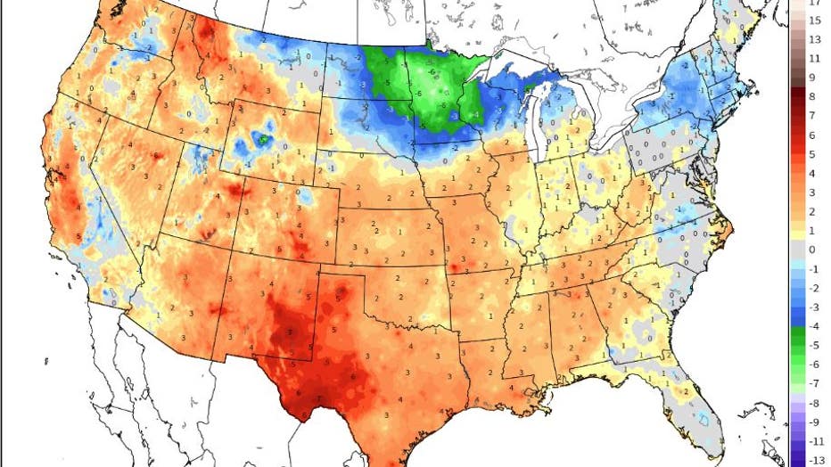
Temperatures when compared to average for the first half of December. Minnesota is well below average so far for the month, but we're just about the only location in the Lower 48 that has experienced some significant cold so far with much of the coun
The cold core of air that has been sitting in central and southern Canada for the last couple of weeks will finally get pushed further north. Minnesota has been getting little pieces of this cold air every few days since the end of November keeping our temperatures at or below average most of the time. Well, looks like that relentless pattern will end. Warm air will surge up from the Desert Southwest and the Pacific Ocean, cross the Rockies, compress, and then warm rapidly as it moves toward Minnesota. This will likely allow temperatures to climb well into the 30s, even in areas with deep snow cover. For some parts of southern Minnesota, low to mid 40s even look likely by the weekend in areas that have very little snow on the ground.
While large scale melting is not expected at the moment, some melting and compacting of the snow pack is expected leading to plenty of slush and slop as we head into Christmas. So what about a white Christmas? Well, I’d say many areas are safe… especially north of the Twin Cities where snowpack is greater than a foot. For parts of southern Minnesota though, where there is generally just a couple inches on the ground, a brown Christmas is looking more likely. For the Twin Cities, it’s a bit of a toss up. Right not, most of the Twin Cities has anywhere from 6"-10” of snow on the ground. While it is exceedingly unlikely that all of this melts, there will likely be enough of a melt to see some scattered brown spots and even melt snow entirely on some south facing rooftops, decks, and hillsides. For the Twin Cities to officially declare a white Christmas, there has to be at least 1” of snow on the ground at MSP Airport around 7am on Christmas morning. It is next to impossible to predict just how quickly snow will compact and melt, but I’d say we will probably still have 3 or even 4 inches of official snow cover by Christmas morning. I guess we’ll see…