

Twin Cities experiences one of the driest June-July combos on record
(FOX 9) - The focus over the last couple of days has certainly been with the smoky and hazy skies, but the dry conditions across much of the Upper Midwest is the main reason why the smoke is around. That’s because the smoke comes several large fires burning north and east of Winnipeg, Canada, where conditions are just as dry as much of Minnesota.
While all of us have certainly seen some rain over the last eight weeks, it’s been nothing close to what we usually get. May, June and July are the wettest months on average for the Twin Cities. We receive almost half of our annual moisture during this 12-week period. This year though, not so much.
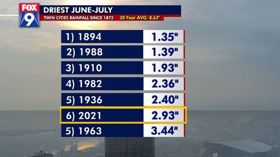
This year will go down as the sixth driest June-July combo on record and the driest since our mega-drought year of 1988 (FOX 9)
With less than 3 inches of rain falling at Minneapolis-St. Paul International Airport since June 1, it will now be the sixth driest June-July combo on record in the Twin Cities and the driest such period since our mega-drought year of 1988.
It’s obviously not just the metro dealing with the very dry conditions, but it’s the entire state and much of the region. Here is a map of the radar estimated percent of average rainfall since June 1 across much of the Dakotas, Minnesota and Wisconsin.
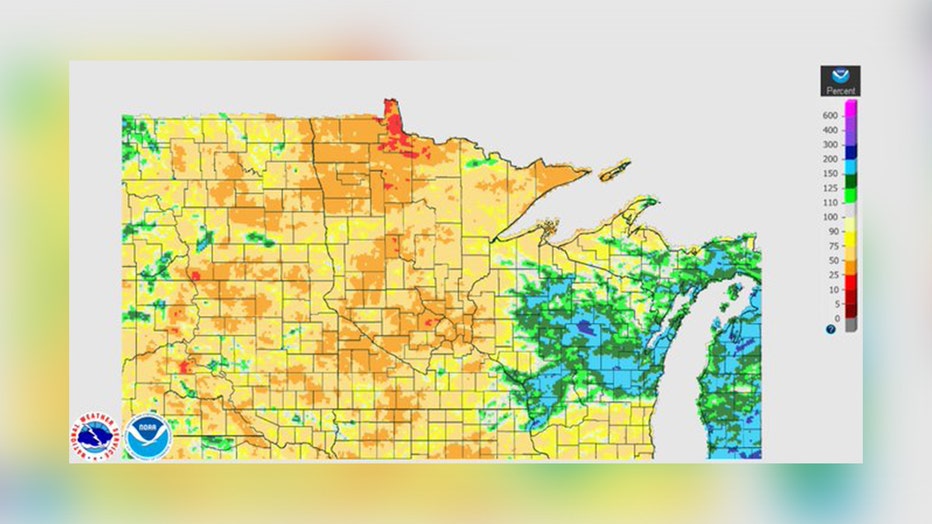
Map of the radar estimated percent of average rainfall since June 1 across much of the Dakotas, Minnesota and Wisconsin. (FOX 9)
It’s very clear who has had moisture and who hasn’t. Central and eastern Wisconsin have managed to see average or above average rainfall over the last eight weeks, but that’s about it. Much of Minnesota has experienced 25%-50% of average rainfall over this time, with some spots in Wright County and near Lake of the Woods with as low as 10% of average moisture.
Unfortunately no significant pattern change is expected over at least the next week, which means the dry conditions are likely to continue for the foreseeable future.