

Minnesota weather: High temps, heat index across the state on Monday
MN weather: Afternoon update on heat, storm chances
Dangerous heat continues across Minnesota, with an extreme heat warning in effect until midnight Tuesday. Severe storms triggered tornado warnings in northern Minnesota Monday afternoon, and additional storms are possible in the Twin Cities Monday night. FOX 9 meteorologist Keith Marler has the afternoon forecast update.
(FOX 9) - Dangerous heat arrived in Minnesota on Monday as temperatures climbed into the lower 90s, and heat index values approached 111 degrees.
Minnesota’s high temps
What we know:
FOX 9 Meteorologist Ian Leonard notes that Red Wing and Marshall saw the highest recorded temps on Monday at 93 degrees – topped in the region only by Eau Claire and La Crosse, Wisconsin, at 94 degrees.
Other highs in Minnesota included MSP Airport at 92 degrees, and a few areas that saw 91 – New Ulm, Faribault and New Richmond.
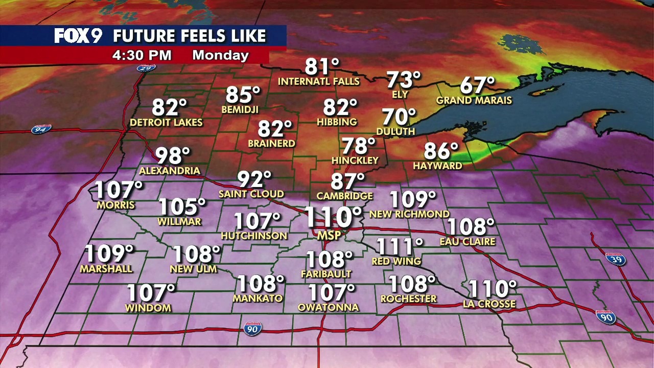
Minnesota heat index
Dig deeper:
Minnesota’s heat index was well over 100 degrees in several areas, with New Ulm leading the state at 111 degrees. Areas nearby such as Willmar saw 108 degrees, while Marshall and MSP both saw 106.
Why it happened:
Leonard notes that the "weather maker" this week is a heat dome located to our southeast, with Minnesota being on the northeast periphery of the dome – a massive area of high pressure that can stretch over hundreds and thousands of miles.
The dome, and its associated strong center of high pressure, traps heat over a specific area. The dome can dominate that area for days at a time, resulting in a heat wave – defined as three days or more above average temperatures, notes Leonard.
Minnesota forecase
What's next:
Storms continue to make their way through the northwest area of the state on Monday, bringing with them patches of strong wind and hail.
Most of the storms should move east of Minnesota shortly after midnight.
Tuesday remains hot and humid, with highs in the low 90s and heat index values near 100 degrees.
Another round of thunderstorms could develop late Tuesday afternoon and evening before moving out overnight.
The pattern remains hot and unsettled through much of the week, with highs in the 90s and periodic storm chances.
The Source: FOX 9 Meteorologist Ian Leonard.