

Thunderstorms with potential for funnel clouds moving east across central MN into WI
Strong storms are possible Tuesday afternoon, July 21.
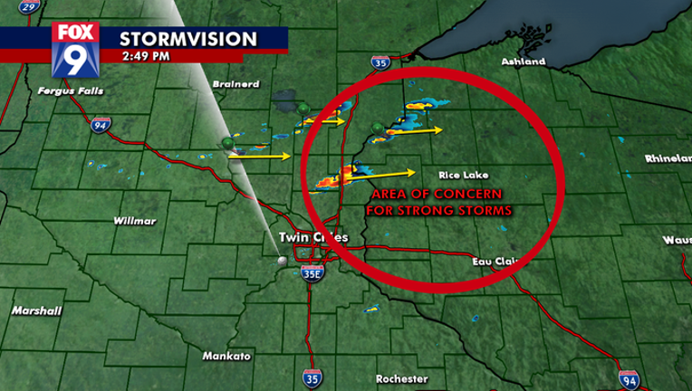
(FOX 9) - After rain showers slowed the morning commute, the components for some strong storms are coming together east and northeast of the Twin Cities metro area Tuesday afternoon.
FOX 9 Chief Meteorologist Ian Leonard says storm cells developed quickly and tracked east Tuesday.
There is a chance of elevated funnel clouds along the I-35W corridor, but areas east of I-35W should stay sky aware, too.
Thunderstorms with the potential for funnel clouds will affect southeast Chisago County.
At 2:58 p.m., thunderstorms were located near North Branch, 14 miles east of Cambridge, moving east at 25 miles per hour.
Get the FOX 9 Weather App to track storms live on your phone, with future radar, live streaming video of FOX 9 coverage and alerts and forecasts customized for your current location and favorite locations: fox9.com/apps