

Minnesota weather: Wet and cloudy Sunday ahead of severe storms on Monday

MN weather: Wet & cloudy Sunday, severe storms on Monday
Cloudy skies will remain throughout Sunday after the morning rain wraps up. Severe storms are expected on Monday. FOX 9 meteorologist Jennifer McDermod has the full forecast.
MINNEAPOLIS (FOX 9) - Gentle showers are starting Sunday morning before severe storms roll into the area tomorrow.
Sunday forecast
Big picture view:
After a rainy morning, things are expected to dry out by Sunday afternoon.
Temperatures will stay average in the mid to low 60s.
Wind gusts from the south could reach up to 20 mph.
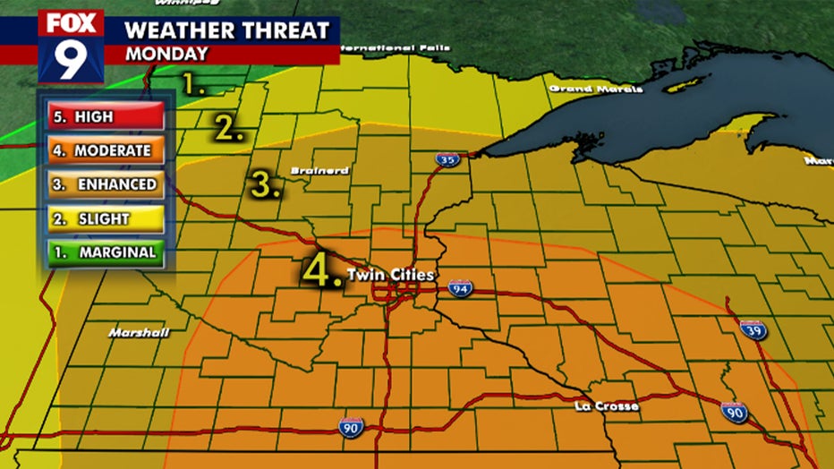
Severe storms Monday
FOX 9 weather forecast. (FOX 9)
What's next:
The first round of storms will hit the metro area around 5 a.m. Monday, bringing with it the potential for large hail.
Strong to severe thunderstorms are expected to hit the Twin Cities metro area and the southeast corner of the state.
There are also threats of tornadoes, large hail, damaging winds and frequent lightning.
Those warnings will be from Monday afternoon to Monday evening.
The northern and western parts of the state will be under an enhanced risk.
There will be a break by the afternoon, with wind from the south and sunshine bringing temperatures into the upper 70s.
However, a cold front will move through on Monday evening, igniting widespread strong to severe thunderstorms.
More information on the severe threats on Monday can be found here.
The Source: This story used information shared by the FOX 9 weather forecast team.