

Minnesota weather: Busiest start to severe weather season in more than 35 years

Severe weather season off to a busy start
So far this year, the National Weather Service office in the Twin Cities has issued a combined total of 228 warnings through May 31. That is by far the most warnings issued by the office to this point in the season since these records began getting tracked in 1986.
(FOX 9) - Memorial Day weekend has long been considered the unofficial start to summer, but it can often be the unofficial start to severe weather season as well. This year though, it had a mid-summer feel with hot and humid conditions that eventually lead to 48 hours of more severe weather. But that was the third major outbreak already for the month, leading to one of the most active starts to the season in decades.
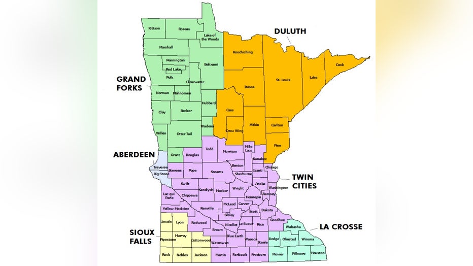
The National Weather Service's coverage map for Minnesota. (The National Weather Service)
As severe weather rolls across the area, the National Weather Service (NWS) issues severe thunderstorm and tornado warnings to alert all of us to head to shelter. The NWS is broken into separate forecasting offices that cover very specific counties in their area with both the forecast, and warning the area when severe weather arrives. The National Weather Service office that covers the Twin Cities is in Chanhassen. They also cover much of the central chunk of Minnesota, along with a lot of western Wisconsin as seen in the image above. The rest of Minnesota is covered by other forecasting offices in La Crosse, Duluth, Grand Forks, Aberdeen, and Sioux Falls.
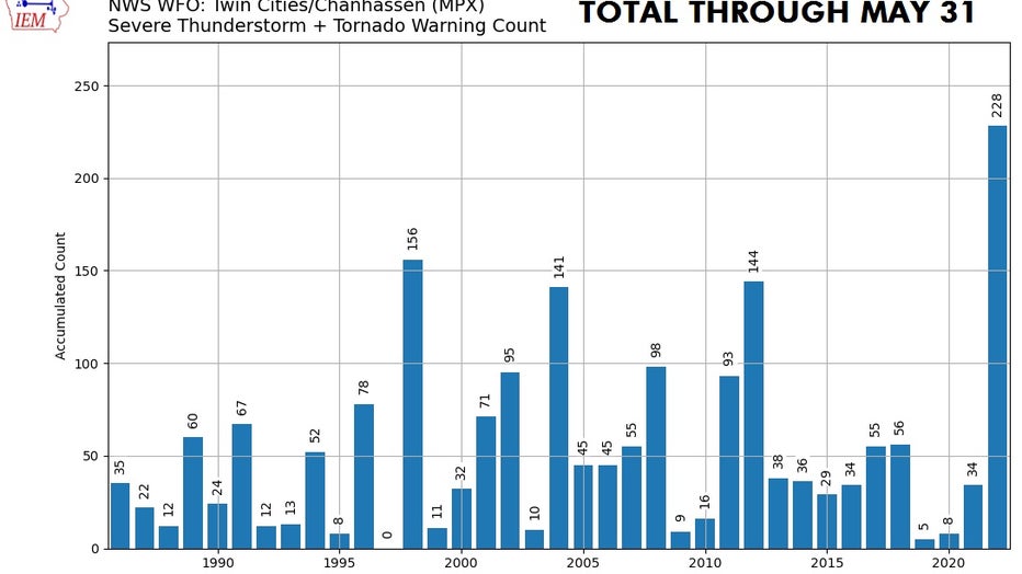
So far this year, the National Weather Service office in the Twin Cities has issued a combined total of 228 warnings through May 31. (National Weather Service)
Well, so far this year, the National Weather Service office in the Twin Cities has issued a combined total of 228 warnings through May 31. That is by far the most warnings issued by the office to this point in the season since these records began getting tracked in 1986. While there isn't a direct correlation between the number of warnings issued and how much damage occurred because of the severe storms, it does paint a pretty stark picture of just how volatile the atmosphere has been so far this year.
RELATED: EF-2 tornado in Forada caused 'extensive' damage; 4 tornadoes confirmed in Minnesota
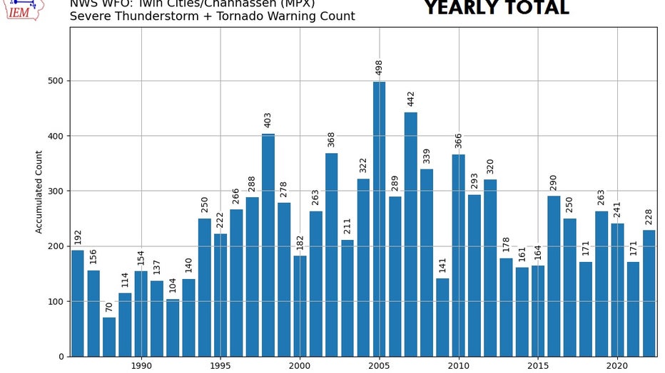
Yearly severe weather warnings in Minnesota. (National Weather Service)
When comparing that number to the entire year, it's tough to see the distinction. However, only five months through the year, we have seen more warnings than all of last year and five of the last 10. What may be more incredible, is that the summer months of June, July, and August are by far the most active for severe weather on average. In the "typical" year, more than 75% of all severe weather reports statewide occur in these three months. While very unlikely, if we have only experienced a quarter of the warnings we're going to get this year, we're in for a really rough season.
Thankfully though, we are in the midst of a break. In fact, if current trends hold, it could be at least a couple of weeks before severe weather opportunities return