

MN weather: Rain totals from Sunday morning storms
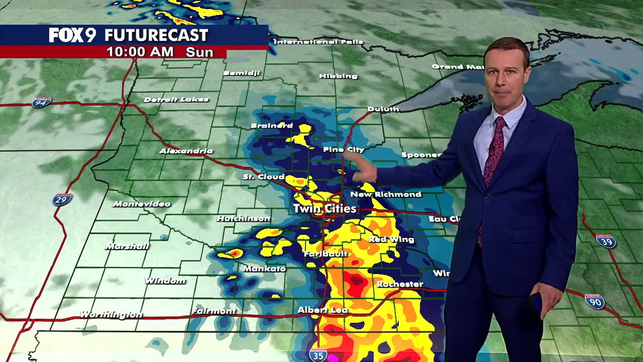
MN weather: Shower and storm chances Sunday morning
Scattered showers and storms are possible Sunday morning ahead of a humid and windy afternoon. Extreme heat arrives to start the week, with heat index values approaching 110 degrees on Monday. FOX 9 meteorologist Jared Piepenburg has the forecast.
MINNEAPOLIS (FOX 9) - Many of us woke up Sunday morning to heavy rain as storms rolled across the Twin Cities metro.
While not severe, many communities got a heavy downpour that dumped as much as an inch of rain in a little more than an hour. Here are rain totals from Sunday’s storms:
Sunday morning rain totals
By the numbers:

Most communities around the Twin Cities got anywhere from a half inch to more than an inch, depending on where you live. Here’s a look at the rain totals:
- Robbinsdale – 1.2 inches
- Carver – 1.16 inches
- Minnetonka – 1.09 inches
- Rogers - .53 inches
- Rockford - .76 inches
- Andover - .59 inches
- Forest Lake - .46 inches
- Scandia - .42 inches
- Somerset, Wis. - .38 inches
- Maple Plain - .95 inches
- Waconia - .82 inches
- Jordan - .60 inches
- Eden Prairie - .87 inches
- Prior Lake - .43 inches
- Lakeville - .31 inches
- Edina - .89 inches
- Minneapolis - .94 inches
- Roseville - .96 inches
- Eagan - .55 inches
- North St. Paul - .78 inches
Here's a look at some other rain totals across the state.

Extreme heat warning Monday
Extreme heat:
A large upper-level ridge will dominate much of the central lower 48, leading to a surge in moisture and heat all the way up into the upper Midwest. Dew points will climb into the upper 60s and even the lower to mid-70s at times, making for sweaty and sticky weather.

High temperatures will generally reach the upper 80s to mid-90s this week, but Monday is expected to be the hottest day. Afternoon highs could climb into the mid to upper 90s, while dew points rise into the low to mid-70s.
This combination will lead to dangerous heat index values, or feels like temperatures, of 105 to 110 degrees on Monday afternoon. An extreme heat warning is in effect for parts of central and southern Minnesota, including the Twin Cities metro, from 9 a.m. Monday until midnight Tuesday.
The rest of the week will be hot and muggy with highs in the 90s and overnight lows in the 70s. Daily storm chances remain in the forecast, mainly during the evening and overnight hours.