

BWCA fires: Officials say rain helped slow growth, but area still dry
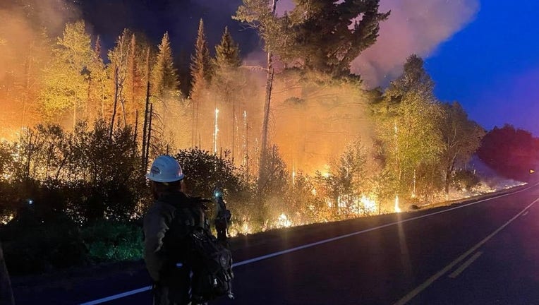
Firefighters combat flames on the southwest side of the Greenwood Fire in the Superior National Forest on August 26, 2021. (U.S. Forest Service)
(FOX 9) - The Greenwood Fire burning in the Superior National Forest in northeastern Minnesota remains about 14% contained, according to the latest update from the U.S. Forest Service.
The Forest Service said crews took advantage of cooler conditions, higher humidity and rain over the weekend to improve fire lines in the west and north parts of the fire to keep it at 25,991 acres as of Monday. Officials say the Superior National Forest saw between 1.5 to 2 inches over the weekend.
Saturday, crews worked to hold the containment lines and prepare future defense operations along Highway 1 and along Stony River Grade Road. To date, the fire has destroyed approximately 14 cabins or homes and 57 outbuildings.

Dozens of buildings destroyed by Greenwood Fire
According to the U.S. Forest Service, the Greenwood Fire has destroyed 12 cabins and homes as well as 57 outbuildings.
The Greenwood Fire, which was started by lightning, was first detected on Aug. 15 around 3 p.m. near Greenwood Lake, about 15 miles southwest of Isabella. The fire is generally located between Greenwood Lake and the intersections of Highways 1 and 2.
Monday, fire crews to plan to continue to gain ground on the work from the weekend to strengthen defensive lines around the fire. They will also work to clean up hazards, like trees that have fallen across roads.
A total of 468 firefighters from multiple states have joined forces to battle the Greenwood fire.
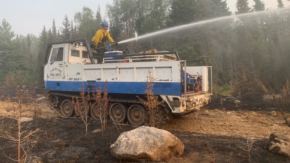
Fire crews carve out defensive lines to slow the Greenwood fire in Minnesota's Superior National Forest. (USDA Forest Service / Supplied)
Fires in Superior National Forest, Boundary Waters
Firefighters are also on the ground for the John Ek and Whelp firs, which are estimated to be around 1,563 acres and 50 acres, respectively. Authorities believe lightning cause both fires, which are each located in the Boundary Waters Canoe Area Wilderness.
Officials said some decent rain did fall in the BWCA, which helped slow the growth of the fires, but the area is still very dry.
Camping closures
Dispersed and backcountry camping - including outside of developed campgrounds - is prohibited in the Superior National Forest until further notice. All campsites on the Superior Hiking Trail are also closed.
Dispersed camping in state forests and backcountry camping in state parks will be closed the northern portion of St. Louis County, and all of Lake, Cook, and Koochiching counties. There is also closure in the upper Gunflint Trail to Forest Service roads, campgrounds, and trails.
Private resorts/campground, developed Superior National campgrounds and non-BWCA lakes are still open unless specifically impacted by nearby fires.
The Forest Service has canceled all permits through Sept. 3, although the closure may be modified or extended.