

Another round of storms moves into Minnesota, western Wisconsin Tuesday
(FOX 9) - Another round of storms have moved into the state Tuesday morning.
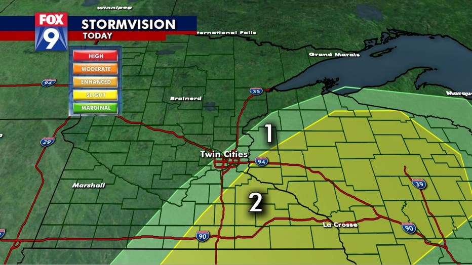
Rain and storms will become more widespread for southeast Minnesota and western Wisconsin, where there is a greater risk for severe weather. Threats include strong winds, hail, periods of heavy rain and the potential for tornado development.
Showers and storms will continue throughout the afternoon and gradually clear Tuesday evening and overnight.
Tuesday will be dominated by clouds, and cooler than average temperatures as a cold front moves through. Expect temperatures to stay in the upper 60s and low 70s.
Wednesday comes with much clearer conditions, as temperatures work back into the low 80s. By the end of the week, we will see the return of heat and humidity.