

MN weather: Severe storms prompt multiple tornado warnings across southern Minnesota
MN weather: Severe threat continues near Mankato
FOX 9 Chief Meteorologist Ian Leonard is tracking severe weather Sunday night in southern Minnesota. There have been multiple tornado warnings near Mankato, and Leon Purvis checks in where he's experiencing heavy rain, strong winds and frequent lightning.
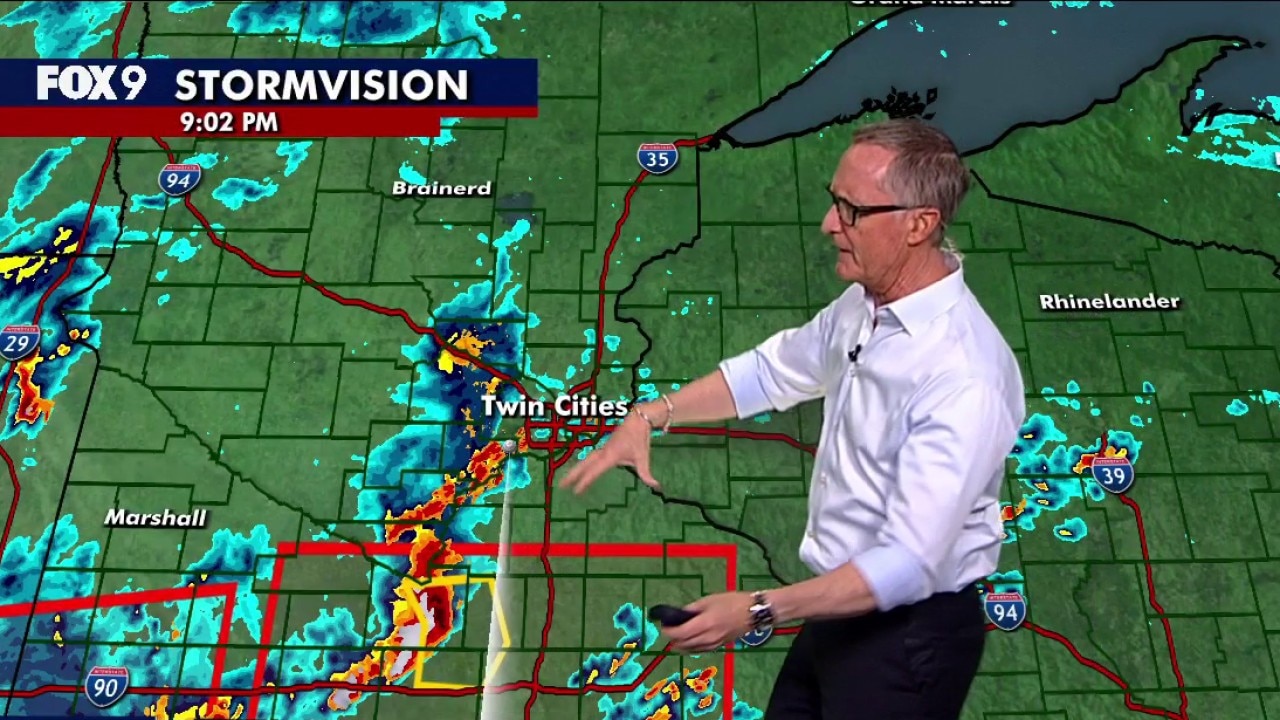
MINNEAPOLIS (FOX 9) - Most of the weekend stayed dry across Minnesota, but Sunday night got a little bumpy across southern Minnesota with severe weather.
Strong to severe storms that started in western and southwestern Minnesota Sunday afternoon tracked east, eventually prompting multiple tornado warnings across much of far southern Minnesota into Sunday night.
Those storms arrived to the Twin Cities just after 10 p.m., but were not deemed severe by the National Weather Service.
See any damage? Share your photos with FOX 9 by visiting fox9.com/photos.
9:50 p.m. - Tornado Warning for Faribault, Freeborn Counties until 10:45 p.m.
The National Weather Service issued a Tornado Warning for Faribault and Freeborn Counties until 10:45 p.m. The areas impacted include Albert Lea, Wells and Clarks Grove.
9:30 p.m. - Tornado Warning for Faribault, Martin Counties until 10:15 p.m.
The National Weather Service issued a Tornado Warning for Faribault and Martin Counties until 10:15 pm.
A tornado-warned storm is impacting Fairmont, Blue Earth and Elmore.
MN weather: Severe threat continues near Mankato
FOX 9 Chief Meteorologist Ian Leonard is tracking severe weather Sunday night in southern Minnesota. There have been multiple tornado warnings near Mankato, and Leon Purvis checks in where he's experiencing heavy rain, strong winds and frequent lightning.
8:30 p.m. - Severe storm threat remains in southern Minnesota
After multiple tornado warnings near Mankato Sunday night, National Weather Services officials say the greatest severe weather threat remains in southern Minnesota.
Another round of storms is expected from the line currently in western Iowa trailing behind an ongoing cluster south of Mankato. This line will contain the best potential for severe wind gusts, and will also have a threat for embedded tornado spin-ups. That line is expected to track east across northern Iowa and southern Minnesota from 9-11:30 p.m.
Far southern Minnesota remains under a Tornado Watch until 1 a.m. Monday.
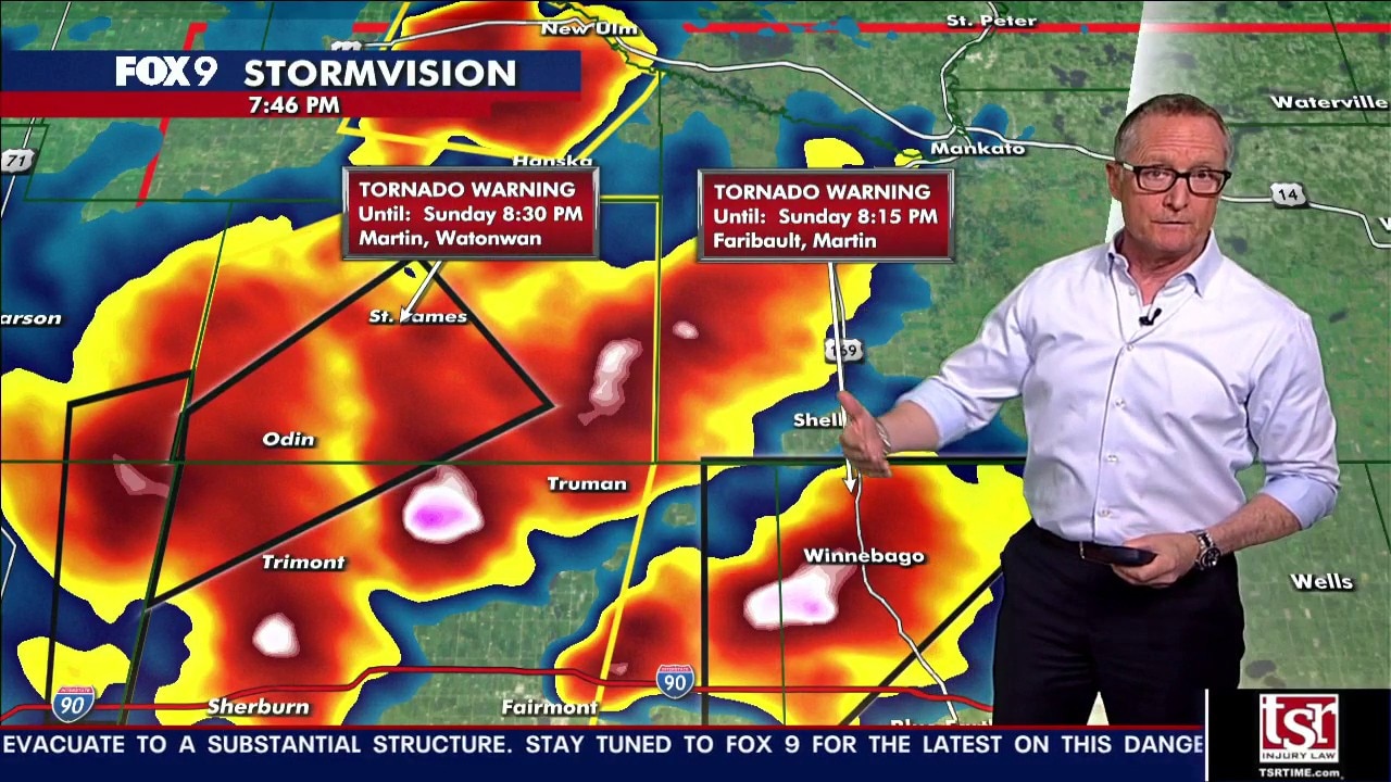
7:15 p.m. – Tornado Warning for Truman, Lewiston, Northrop until 8:15 p.m.
The National Weather Service issued a Tornado Warning for Martin County in effect until 7:45 p.m.
National Weather Service officials say the storm produced a short rope tornado that was on the ground for a minute before lifting, but the storm is still showing signs of rotation. Areas impacted include Truman, Lewiston and Northrop, which is southwest of Mankato.
MN weather: Tornado warnings in southern Minnesota
FOX 9 Chief Meteorologist Ian Leonard is tracking a bumpy night of severe weather in southern Minnesota. There have already been multiple tornado warnings near Mankato.
6:15 p.m. – Southern Minnesota under Tornado Watch
The National Weather Service has issued a Tornado Watch until 1 a.m. Monday for portions of southern and southwestern Minnesota. The watch currently does not include the Twin Cities metro.
Sunday storm outlook
The backstory:
FOX 9 Meteorologist Jared Piepenburg says we should stay sky aware Sunday night. Western, central and southern Minnesota are at a Level 2 (Slight) risk for severe weather. Far southwestern Minnesota is at a Level 3 (Enhanced), while northern Minnesota has a marginal risk as crews battle wildfires near Breezy Point and Two Harbors.
Storm timeline – What to expect
Timeline:
Thunderstorms move into western and southern Minnesota around dinner time Sunday and are expected to push east. Strong to sever storms should arrive to the Twin Cities metro sometime after 10 p.m., and they are expected to clear out before the Monday morning commute.
The initial threat with these storms is large hail, strong winds and an isolated tornado as well as heavy rain.
As of 3:30 p.m. Sunday, a Tornado Watch has been issued for Cottonwood and Jackson Counties until 10 p.m. There are no current watches near the Twin Cities metro.