

Red flag warning issued for much of MN on Saturday
MN weather: Chilly Friday leads to warm, dry weekend
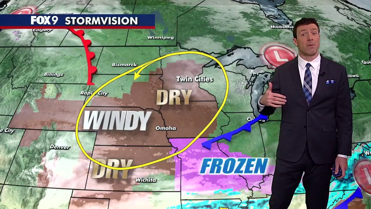
A slightly chillier Friday will lead into a warmer weekend that also presents a high fire danger throughout the state.
MINNEAPOLIS (FOX 9) - A red flag warning is in effect on Saturday for much of Minnesota, including the Twin Cities metro, with the National Weather Service warning of dangerous fire weather conditions.
Critical fire weather in MN

Image shared by the National Weather Service shows the Minnesota counties under a red flag fire warning. (Supplied)
Local perspective:
The National Weather Service says the combination of warmer temperatures near 60 degrees, low relative humidity between 15–20%, southwest winds gusting to 35–45 mph and dry fuel will lead to critical fire weather conditions across central and southern Minnesota on Saturday.
The red flag warning is in effect from noon to 7 p.m. on Saturday for the majority of the warning area. However, portions of southern Minnesota are under a red flag warning from 10 a.m. to 9 p.m. on Saturday.
The counties under a Red Flag warning include Aitkin, Anoka, Becker, Benton, Big Stone, Blue Earth, Brown, Carlton, Carver, Cass, Chippewa, Chisago, Cottonwood, Crow Wing, Dakota, Dodge, Douglas, Faribault, Fillmore, Freeborn, Goodhue, Grant, Hennepin, Houston, Hubbard, Isanti, Itasca, Jackson, Kanabec, Kandiyohi, Lac Qui Parle, Le Sueur, Lincoln, Lyon, Martin, McLeod, Meeker, Mille Lacs, Morrison, Mower, Murray, Nicollet, Nobles, Olmsted, Otter Tail, Pine, Pipestone, Pope, Ramsey, Redwood, Renville, Rice, Rock, Scott, Sherburne, Sibley, St. Louis, Stearns, Steele, Stevens, Swift, Todd, Traverse, Wabasha, Wadena, Waseca, Washington, Watonwan, Wilkin, Winona, Wright, and Yellow Medicine.
Why you should care:
The weather service warns that any fires that develop will spread rapidly. Outdoor burning is not recommended on Saturday.
Big picture view:
There is critical fire weather across much of the central United States due to warm weather and dry conditions, according to the weather service.
Minnesota weather forecast
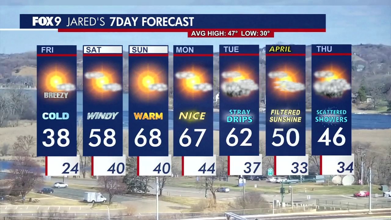
MN weather: Friday forecast update
FOX 9's Jared Piepenburg shares an update on the Minnesota weather forecast for March 27, 2026.
What's next:
Saturday brings warmer temperatures, along with gusty southwest winds. Highs climb into the upper 50s, with wind gusts reaching into the 30 mph range.
Sunday turns even warmer, with highs nearing 70 degrees under mostly sunny skies and lighter winds.
Monday remains mild, with highs in the upper 60s. A few showers are possible Tuesday as another system moves through. Temperatures cool back into the 50s and 40s by midweek, with additional shower chances by Thursday.
The Source: This story uses information from the National Weather Service.