

Minnesota weather: Heat advisory for Twin Cities as Friday turns hot and humid
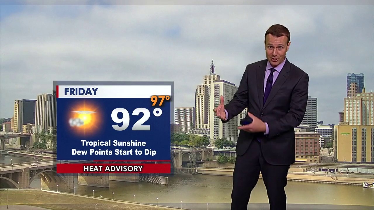
MN weather: Friday afternoon forecast update
FOX 9 meteorologist Jared Piepenburg has the latest forecast update.
MINNEAPOLIS (FOX 9) - A heat advisory is in effect for the Twin Cities metro area as feels-like temperatures climb into the upper 90s on Friday.
Friday’s forecast in Minnesota
The forecast:
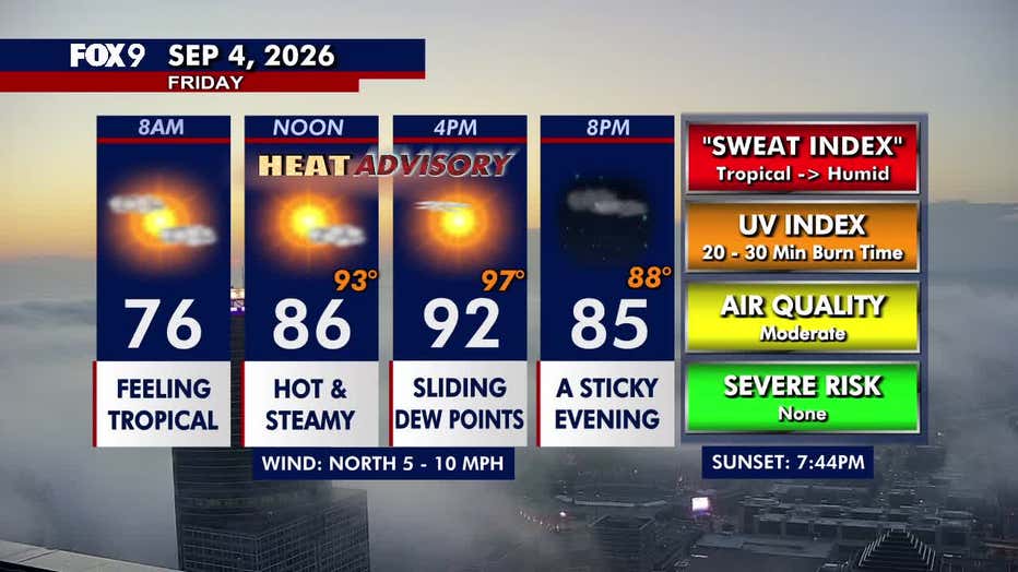
Friday starts with some clouds before skies clear for plenty of afternoon sunshine. Dew points will slide in the afternoon, though it will still be plenty humid. Northerly winds remain light at 5 to 10 mph.
Temperatures climb into the upper 80s and low 90s across central and southern Minnesota, while northern Minnesota stays cooler in the 70s. The Twin Cities metro tops out around 92 degrees.
Friday night turns warm as clouds return, and patchy fog develops late. Overnight lows stay in the upper 60s and low 70s across central and southern Minnesota, while northern Minnesota cools into the 50s. A stray thunderstorm can’t be ruled out for far southwestern Minnesota.
(FOX 9)
Heat Advisory for Twin Cities
What to expect:
The National Weather Service has issued a heat advisory for the Twin Cities metro area from 1 p.m. to 6 p.m. on Friday. The impacted counties include Anoka, Carver, Dakota, Hennepin, Ramsey, Scott and Washington.
Hot temperatures and high humidity will push heat index values into the upper 90s. Temperatures in the Twin Cities metro are expected to feel around 97 degrees during the afternoon.
The NWS warns these conditions may cause heat-related illness and encourages people to stay out of the sun, drink plenty of fluids, and try to stay in air-conditioned rooms.
Labor Day weekend forecast in Minnesota
What's next:
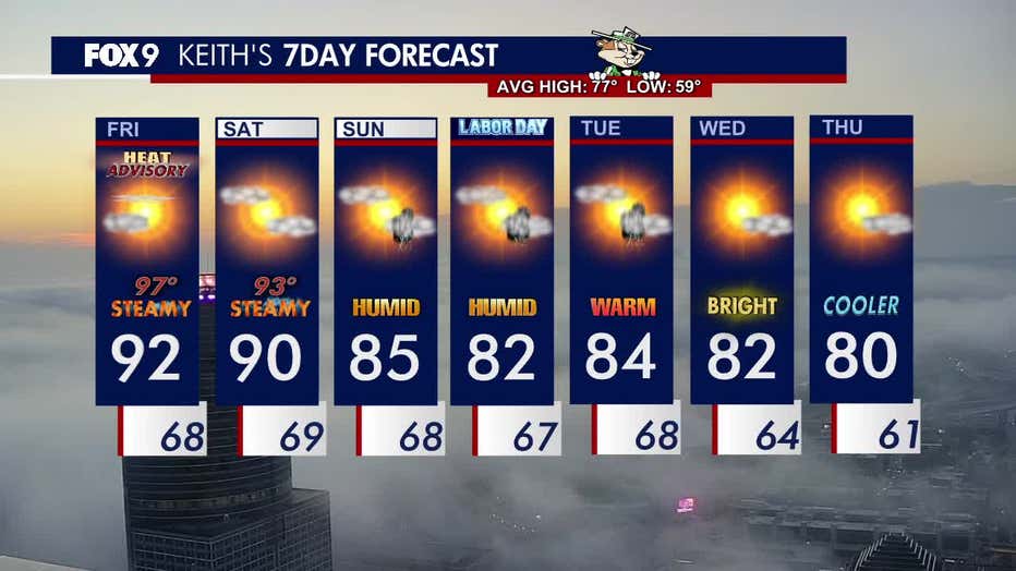
Saturday stays hot and steamy, though conditions will be slightly less intense than Friday. The Twin Cities metro reaches a high of around 90 degrees, while heat index values remain in the low 90s. Dew points stay in the mid to upper 60s, accompanied by easterly winds around 5 to 10 mph.
Sunday turns a little more comfortable as temperatures fall into the mid-80s. Southeasterly breezes bring some additional cloud cover, along with a chance for thunderstorms Sunday evening and Sunday night.
Temperatures turn more comfortable for Labor Day on Monday, with highs in the low 80s. An isolated storm chance may linger into Monday and Tuesday.
Humidity and temperatures in the 80s continue through much of next week.
Here’s a look at the seven-day forecast:
(FOX 9)
The Source: This forecast uses information from FOX 9 meteorologists.