

Minnesota weather: Warmer, breezy with isolated light rain showers Wednesday
MN weather: Warmer and breezy Wednesday
Expect a much warmer and breezy day on Wednesday before a cold front brings light isolated rain showers and cooler temperatures. FOX 9 meteorologist Cody Matz has the forecast.
MINNEAPOLIS (FOX 9) - Wednesday will be warm and breezy in the Twin Cities metro before a cold front moves through, bringing isolated showers and cooler temperatures.
Wednesday's forecast in Minnesota
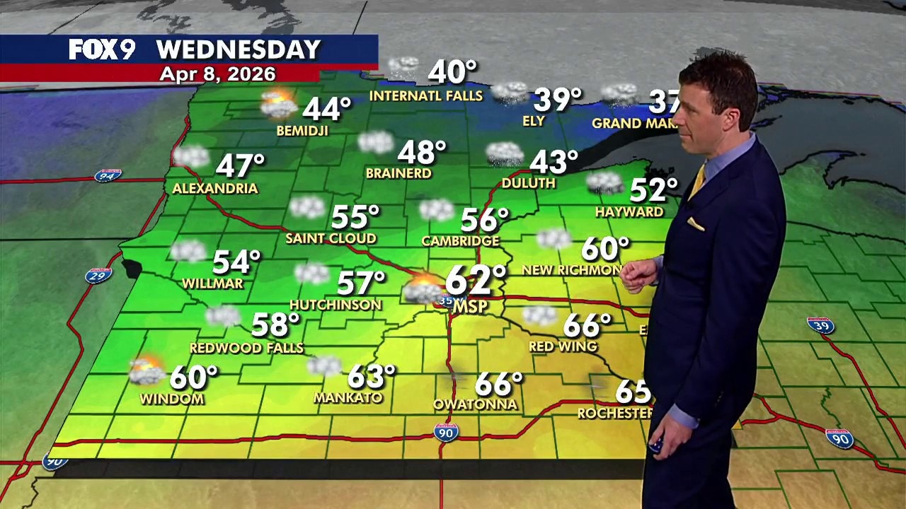
The forecast:
Temperatures in the metro climb into the low 60s around midday before sliding back into the 50s as a cold front moves through. Much of Minnesota stays in the 50s, while northern Minnesota remains cooler in the 40s.
Southerly winds at 10-20 mph help bring in the warmth early, then shift to the west later in the day as the cold front passes. A few isolated showers are possible in the metro during the afternoon, with a better chance for a rain or rain-snow mix across northern Minnesota.
Wednesday night turns cooler and calmer with passing clouds and lows in the 30s.

(FOX 9)
Extended Minnesota weather forecast
What's next:
Thursday starts bright before clouds increase through the afternoon. Highs reach the lower 50s, though cooler 30s and 40s hold across central and northern Minnesota. A stray evening sprinkle is possible, mainly in southern Minnesota.
Friday looks pleasant with little wind, plenty of sunshine and highs in the upper 50s. Temperatures climb back into the 60s on Saturday with shower chances returning.
Sunday and Monday turn even warmer, with highs in the mid-70s and the potential for showers and thunderstorms. A sharp cooldown follows as temperatures drop back into the 50s by Tuesday.
Here's a look at the seven-day forecast:

(FOX 9)
The Source: This story uses information from FOX 9 meteorologists.