

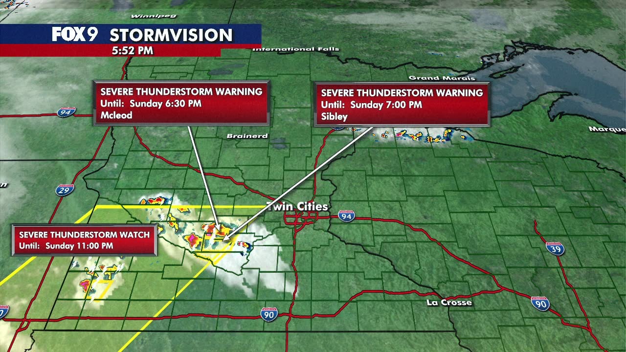
MN weather: SW Minnesota under Thunderstorm Watch until 11 p.m.
MN weather: Sunday night storms, Memorial Day forecsat
FOX 9's Erika Mrazik has your Memorial Day weekend forecast. Some parts of Minnesota will see storms Sunday night, while Monday will be hot and sunny.
MINNEAPOLIS (FOX 9) - After a cool and cloudy start to Memorial Day weekend, the sun and warmer temperatures finally arrived on Sunday.
Along with that, parts of Minnesota are at risk for severe weather.
Severe Thunderstorm Warning for Nicollet County until 7:15 p.m.
The National Weather Service issued a Severe Thunderstorm Warning for Nicollet County until 7:15 p.m. Areas impacted include St. George, Lafayette and Klossner.
The biggest threat with this storm is winds up to 60 mph, and quarter-size hail.
Thunderstorm Warning until 5:30 p.m
The National Weather Service issued a Severe Thunderstorm Warning for Kandiyohi, Meeker and Renville Counties until 5:30 p.m.
SW Minn under Thunderstorm Watch until 11 p.m.
The National Weather Service issued a Severe Thunderstorm Watch until 11 p.m. that includes portions of far southwestern Minnesota. It does not include the Twin Cities metro.
The watch area includes Willmar, Redwood Falls, Marshall, Worthington, St. James and extends to Mankato, getting as close to the Twin Cities as Glencoe. The biggest threat with storms Sunday night is large hail.
Sunday forecast
After a sunny start, the warm weather continues with mostly sunny skies and a high in the upper 80s across most of the state. We’ll also be keeping an eye out for more storms.