

Minnesota weather: Off-and-on storms the next few days, steamy midweek

MN weather: Stormy, hot week ahead
We will be tracking some storms and some temps in the 90s over the coming week. Jared Piepenburg has your forecast.
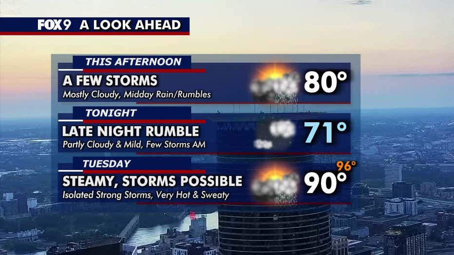
MINNEAPOLIS (FOX 9) - Showers and storms will likely reach the Twin Cities on Monday morning, kicking off a stretch of unsettled weather and building humidity.
Monday’s forecast in Minnesota
Storm chances:
Clouds will increase throughout the morning with showers and storms possibly arriving in the metro by late morning or midday. These storms carry a level 1 marginal risk of severe weather.
The National Weather Service issued a special weather statement until 8:45 a.m. for Plymouth, Maple Grove and Eden Prairie due to the threat of 40 mph winds and small hail.
What else:
The storms will push out by the afternoon, ending the day on a quieter note. Temperatures range from the 70s to the low 80s across Minnesota. The Twin Cities metro will top out at around 80 degrees.
(FOX 9)
Extended forecast
What's next:
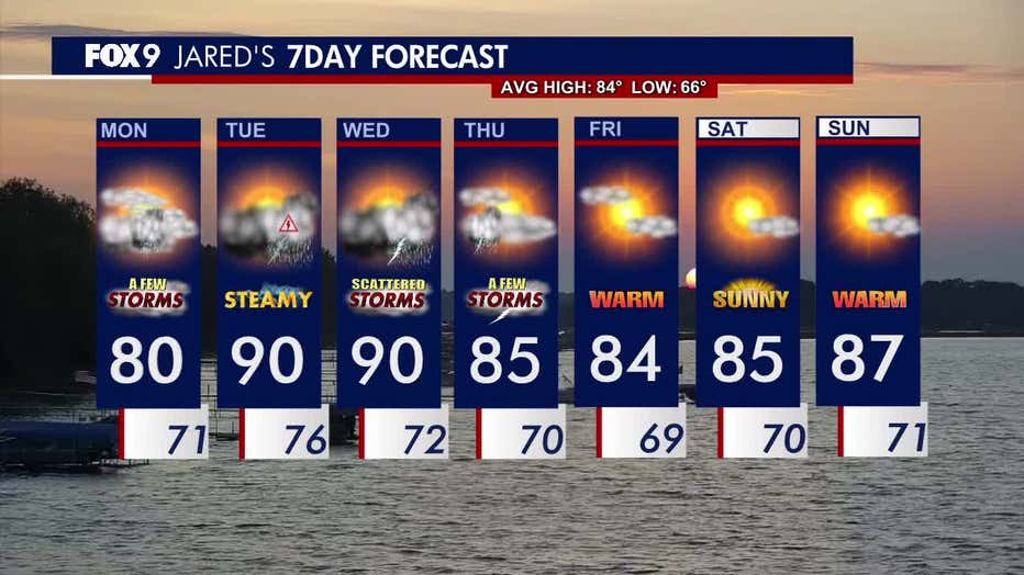
Storm chances continue into Thursday, with the best chance of severe weather happening on Tuesday. The main threats are damaging wind and small hail.
Temperatures climb into the low 90s mid-week, with the heat index values in the mid-90s. Wednesday will be hot and sticky with periods of off-and-on showers and rumbles.
By Friday, temperatures return closer to seasonable, with a much calmer weekend ahead.
Here’s a look at the seven-day forecast:
(FOX 9)
The Source: Information for this story was provided by FOX 9 meteorologists.