

Winter weather hits Minnesota, snow will accumulate into Wednesday
(FOX 9) - Tuesday was cloudy and seasonable with steady temperatures in the mid-30s, but snow quickly spread from the southwest to the northeast in the evening, arriving into the Twin Cities metro area Tuesday night.
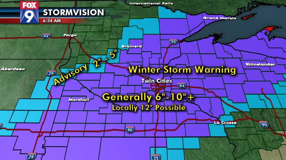
A Winter Storm Warning will be in effect for much of Minnesota and northwestern Wisconsin from Tuesday night until noon on Wednesday.
Heavy snow and gusty winds are likely overnight and early Wednesday, but it will taper off by midmorning. Final snow totals of 6-11 inches look likely in the warning areas.
Wind gusts of 40 miles per hour Tuesday night and reduced visibilities will make travel a big problem.
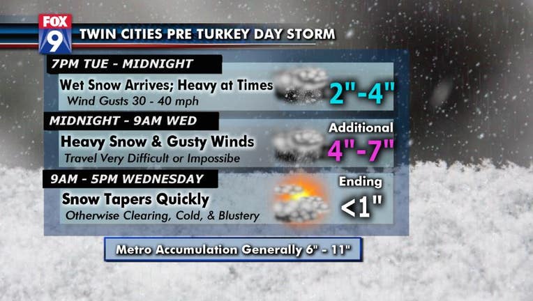
SNOW TIMELINE
7 p.m. Tuesday-Midnight: Wet snow arrives, heavy at times. Wind gusts will be between 30-40 mph, 2-4 inches of snow possible
Midnight-9 a.m. Wednesday: Heavy snow and gusty winds. Travel will be very difficult or impossible, an additional 4-7 inches of snow possible
9 a.m.-5 p.m. Wednesday: Snow tapers quickly, otherwise clearing, cold and blustery. An additional inch or less of snow is possible.
Stay up to date on the winter weather by downloading the FOX 9 Weather App. It has the latest temperatures, snow totals, forecasts and school closings 24/7. Download it for Android or Apple.