

7 tornadoes confirmed in Chicago suburbs during Monday's storms
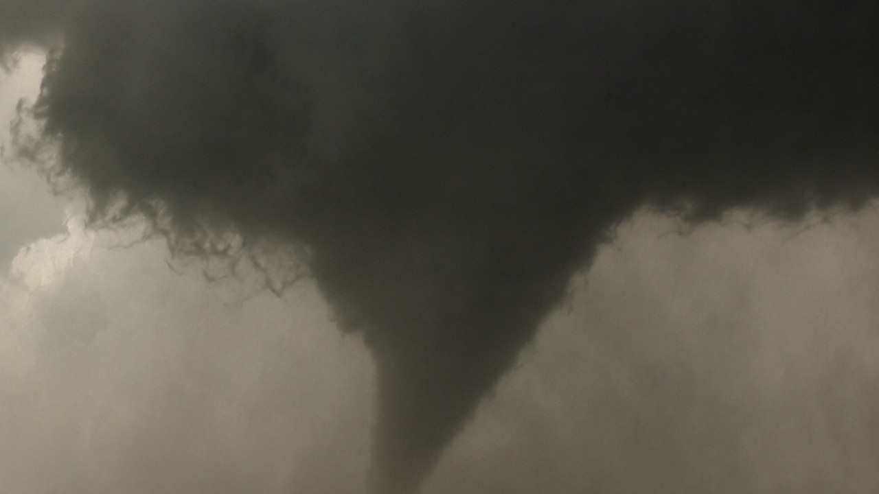
Chicago has already seen more severe storms than all of 2025, NWS says
National Weather Service meteorologist Kevin Doom explains why this has been one of the busiest severe weather seasons on record for the Chicago area, how tornadoes are confirmed, and what could still be ahead this summer.
CHICAGO - The National Weather Service has confirmed at least seven tornadoes touched down in the Chicago suburbs during Monday's severe weather outbreak.
Tornadoes in Chicagoland
What we know:
All of the tornadoes confirmed in the Chicago suburbs from Monday, according to the NWS:
- EF-0 in Glen Ellyn
- EF-0 in Wheaton
- EF-0 in Downers Grove
- EF-0 in Romeoville
- EF-0 in Orland Park
- EF-1 in Hazel Crest
- EF-1 in Lansing
An EF-1 tornado damaged parts of Country Club Hills, Hazel Crest, Harvey and Homewood, according to the NWS. An EF-0 tornado also crossed over western and northwestern Orland Park.
One tornado tracked through Lansing before lifting just east of the Illinois-Indiana state line in Munster, Indiana. The storm was rated EF-1 on the Enhanced Fujita Scale, with estimated peak winds of 110 mph, according to the NWS.
Meteorologists also confirmed an EF-0 tornado struck Glen Ellyn in DuPage County, producing peak winds of about 80 mph.
An additional tornado was identified by the NWS on Wednesday. Officials said an EF-0 tornado took place just south of Wheaton College with winds of up to 75 mph.
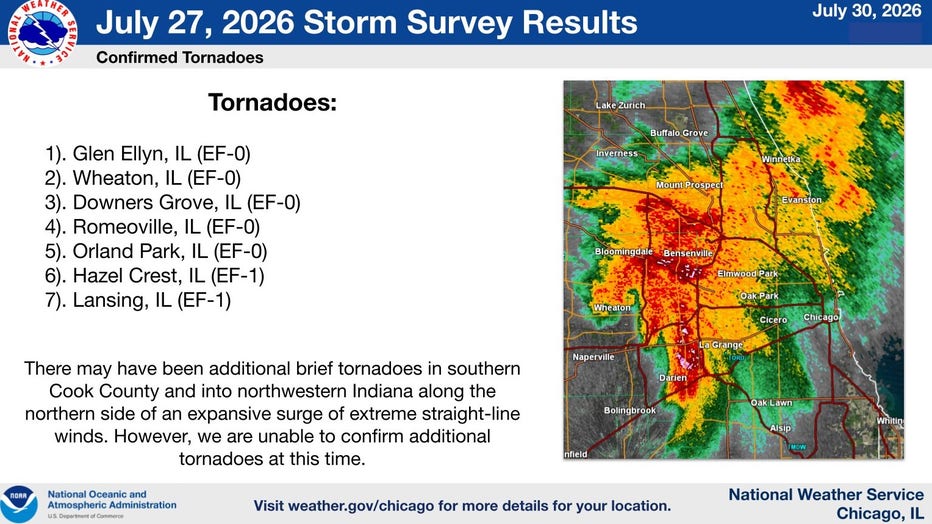
In addition to the tornadoes, survey teams found evidence of damaging straight-line winds exceeding 70 mph in both Carol Stream and Downers Grove, where strong thunderstorms caused wind damage but no tornadoes.
The National Weather Service also reviewed video showing what appeared to be a possible tornado near Watseka in Iroquois County. However, investigators said they were unable to confirm that the funnel cloud actually touched the ground, so it will remain classified as a funnel cloud rather than a tornado.
Tornadoes near Chicago in 2026
By the numbers:
It has been a very active year across the Chicagoland area for tornadoes. The four confirmed tornadoes from Monday bring the 2026 tornado count up to 62 in the Chicago National Weather Service forecast area. The 30-year average sits at just 16 tornadoes, so we are once again well above normal.
Chicago weather: Showers and storms return to the area this weekend
Fox Chicago Chief Meteorologist Emily Wahls breaks down tonight's weather outlook.
What's next:
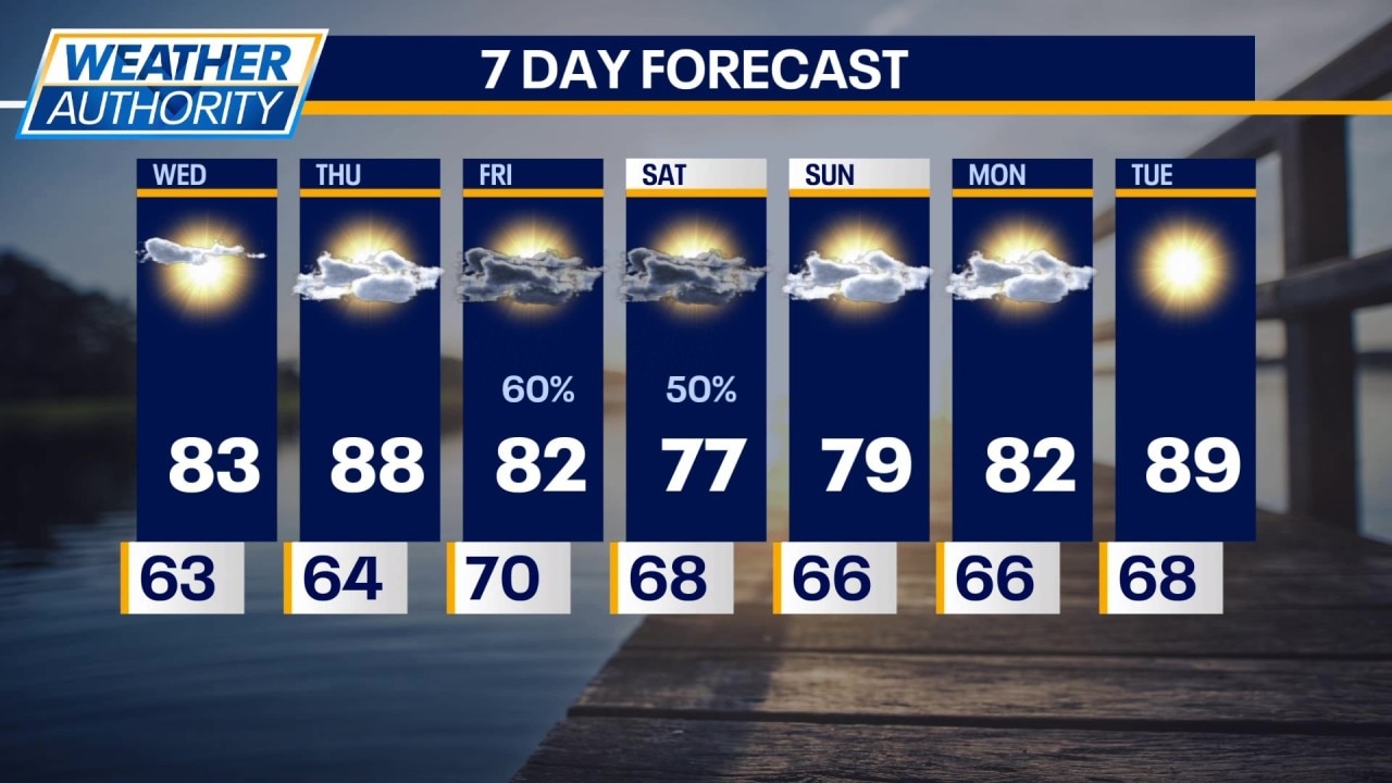
We have calmer days ahead with sunny skies on Wednesday and partly cloudy skies on Thursday. Temperatures will be in the lower 80s tomorrow and upper 80s Thursday afternoon.
Our next chance of rain and storms will arrive on Friday, lasting into Saturday. Temperatures will be in the lower 80s on Friday and then mid to upper 70s on Saturday. Sunshine returns Sunday with highs in the upper 79s to near 80 degrees.
The Source: The information in this report came from the National Weather Service and Fox Chicago Chief Meteorologist Emily Wahls.