

Minnesota waterways falling to near-record lows as meaningful moisture stays away

Twin Cities seeing driest October in over 40 years
Despite the light rain earlier this week, the dry conditions in the Twin Cities and much of the southern half of the state continue to get worse. That's after one of the driest 5 month stretches on record, with little relief in sight. Lake Minnetonka is at its lowest water level since 2000, and other waterways are also well below normal.
MINNETONKA, Minn. (FOX 9) - Despite the light rain earlier this week, the dry conditions in the Twin Cities and much of the southern half of the state continue to get worse. That's after one of the driest 5-month stretches on record, with little relief in sight.
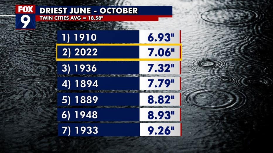
The Twin Cities saw one of the driest five months on record, from June-October. (FOX 9)
We are rounding out October on another dry note as we have seen just twenty-four hundredths of an inch of rain for the month, that's the sixth-driest on record and the driest in more than 40 years. This is on the heels of the driest September on record and the fourth-driest summer on record. That has led to a rainfall deficit of nearly a foot just since the first of June, creating some of the driest conditions the Twin Cities has experienced dating all the way back to the 1800s.
RELATED [Oct. 6, 2022]: Twin Cities metro reaches 'extreme drought' conditions for the first time this year
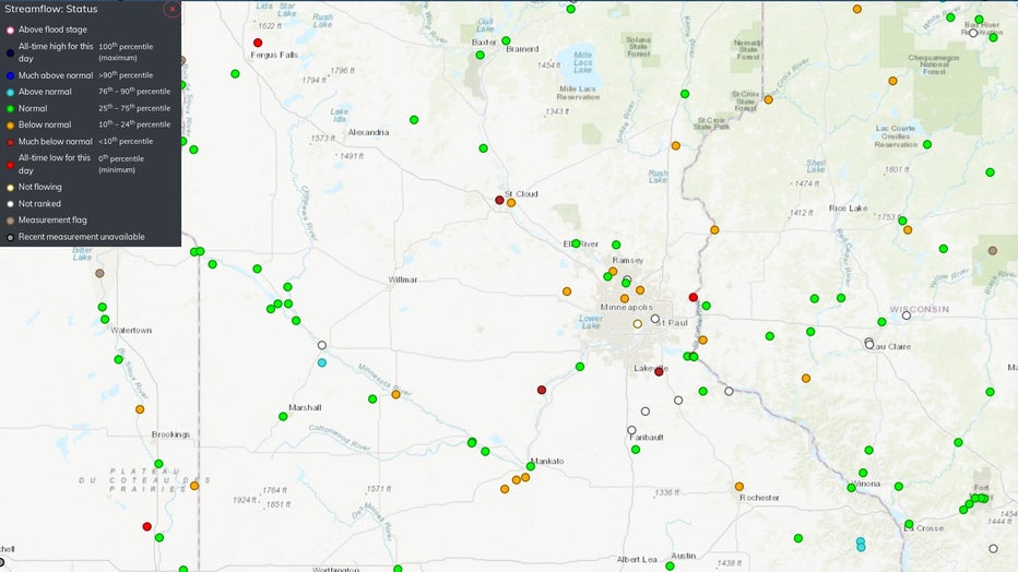
Water levels on Minnesota waterways. (USGS)
Now our waterways are showing it, with record or near-record low levels on the Crow, Zumbro, and Sauk rivers. Even sections of the St Croix River near Stillwater and the Mississippi River near St Cloud. Every orange or red dot on the map (above) indicates record low or near-record low stream flow in these locations for this time of year.
RELATED [Sept. 1, 2022]: Minnesota oak trees showing signs of drought, insect infestation
But it's not just our rivers. Lake Minnetonka is now at its lowest level since 2000 and in one of the lowest stretches since Gray's Bay Dam was built to control the water levels of the lake back in 1979. It's now more than a foot below what's considered "standard pool" and nearly 2.5 feet below full pool – a level that was reached just a couple of years ago.
Here is a graph that shows the water level of the lake since ice out in the spring, with the gradual fall of water levels since the rain shut off in early June:
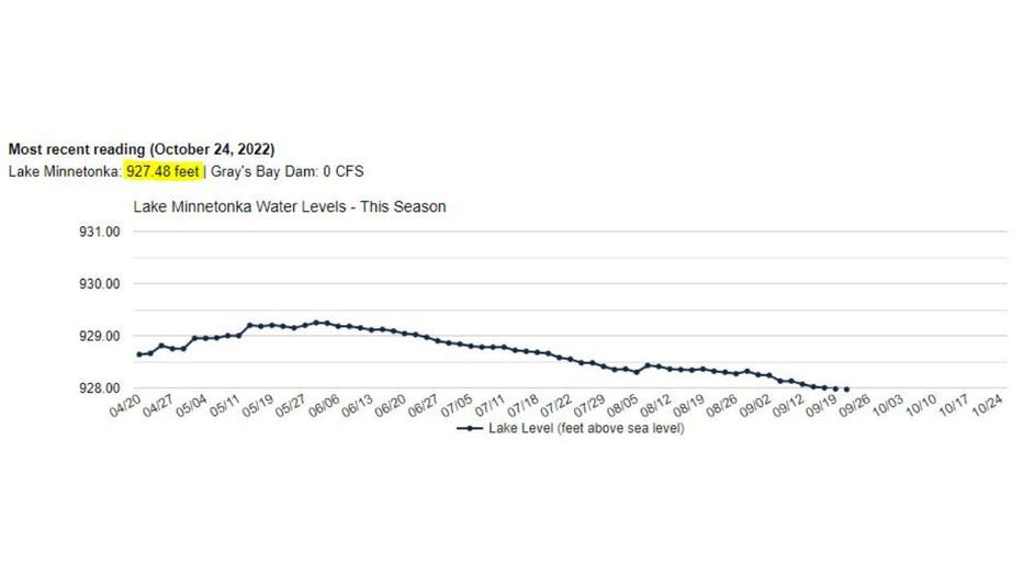
Lake Minnetonka water levels.
The water height on the lake is measured in feet above sea level, so as of Wednesday it stands at 927.48 feet and is continuing to fall.
Not all areas are created equal though. Below is the current drought monitor with the Twin Cities metro and much of the Minnesota River Valley in the severe to extreme categories. However, areas just to the north near St Cloud to Brainerd and Duluth have seen a lot more rainfall over the last few months.
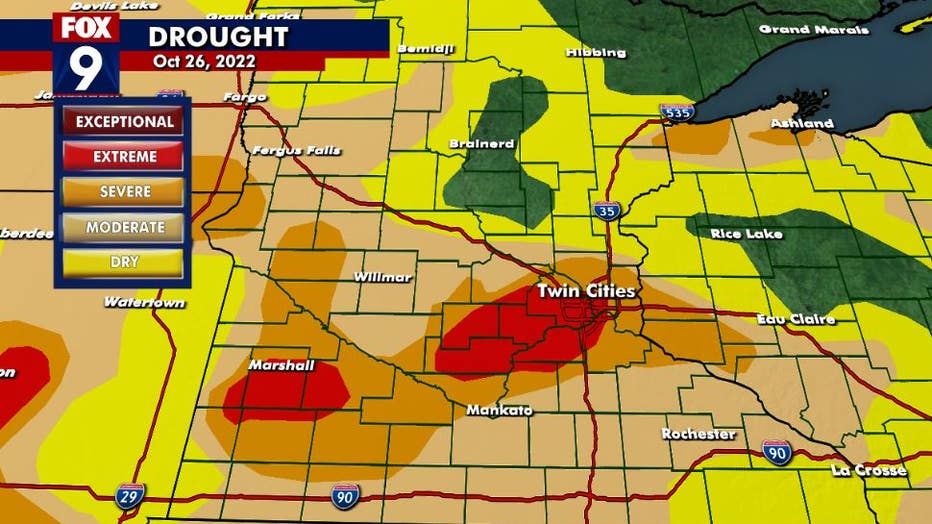
Drought levels in Minnesota in October.
Now we are just a few weeks or less away from the ground freezing, that's the point when any moisture, either rain or snow, will no longer soak into the ground. Past this point drought improvement is not possible until at least March when the ground begins to thaw.
However, an above-average snow season would lead to improvements in lakes and waterways when the ice melts in the spring.

Barges getting stuck on Mississippi River amid drought
Parts of Minnesota are now in "extreme drought," and the ongoing drought is causing problems on the Mississippi River. Barges are getting stuck in the river, which is impacting crop shipments.